A practical analysis for visitors, foreign residents, and local users
Purpose: Explain what a visitor or local resident actually needs to know to move around China: high-speed rail, conventional rail, metro, bus, taxi, ride-hailing, private vehicles, airport transfers, ferries, scenic-area shuttles, bicycles, payment systems, accessibility, safety, and the recurring friction points travelers and locals experience.
Executive summary
China is one of the easiest countries in the world to cross quickly by rail and one of the easiest countries to make harder than necessary if you arrive unprepared. The system is powerful, digital, fast, and dense in major cities. It is also identity-based, app-dependent, station-specific, and uneven once you leave big-city metro corridors.
For national travel, China’s high-speed rail is the backbone. By the end of 2025, official reporting said China’s operating high-speed rail mileage had exceeded 50,000 kilometers, making it the world’s largest high-speed rail network by a wide margin. In 2025, China’s railway system handled nearly 4.59 billion passenger trips, which shows why rail is not a niche tourist tool but an everyday national mobility system. For most intercity trips between major cities in eastern and central China, rail should be the first option checked before flights.
For city travel, metros are the visitor’s default in Beijing, Shanghai, Xi’an, Chengdu, Guangzhou, Shenzhen, Hangzhou, Suzhou, and Chongqing. They are usually faster than surface roads, have bilingual signage, connect major rail stations and airports, and are easier to understand than bus systems. However, metro systems are not equally useful everywhere: Guilin, Zhangjiajie, and Sanya are dominated by buses, taxis, ride-hailing, private transfers, scenic shuttles, ferries, boats, and regional rail rather than subway networks.
For payment, visitors should prepare Alipay and WeChat Pay before arrival, then carry cash and a physical payment backup. China is highly cashless in daily life. The U.S. State Department notes that most people in China pay through mobile apps such as WeChat and Alipay, and official local guidance from Hangzhou says overseas travelers can link international cards to Alipay. Foreign bank-card acceptance on public transport is improving in some cities, especially Shanghai, Beijing, and Guangzhou, but it is not a universal national substitute for mobile payment.
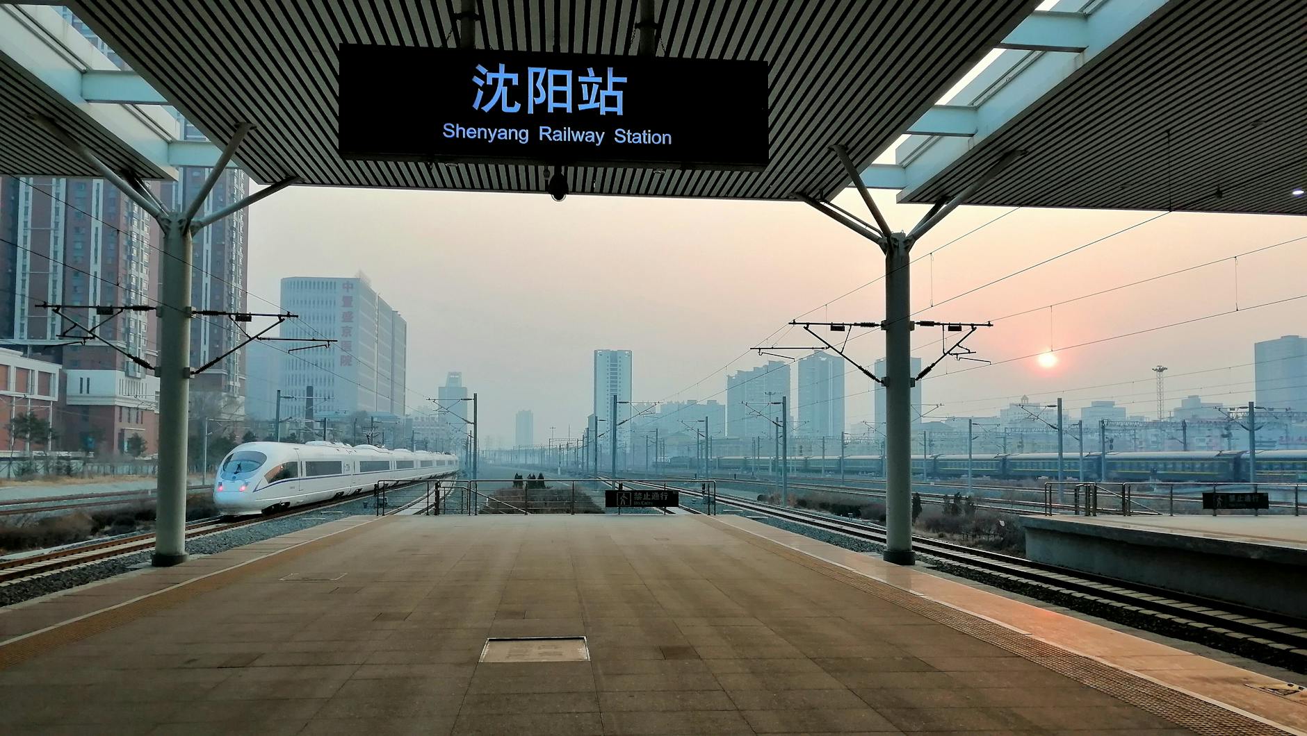
For rail, the critical fact is that China uses real-name ticketing. China Railway’s official 12306 English FAQ says foreign passengers can use valid passports to buy real-name railway tickets. Beijing’s official foreigner guidance also explains that passengers should present the same valid identity document used for ticket purchase when entering the station and taking the train. A visitor should treat the passport as part of the transport system, not something left in a hotel safe on travel days.
For navigation, do not rely only on a familiar global map app. Amap/Gaode and Baidu Maps are the strongest local tools. Amap launched an English map for overseas users in 2025 and later added more multilingual features, but Chinese place names still produce better results. Save hotel addresses, station names, attraction names, and pickup points in Chinese. In China, the difference between “Beijing South,” “Beijing West,” and “Beijing Chaoyang” is not a detail. It is the difference between catching a train and missing it.
Locals experience China’s transportation system differently from tourists. A visitor notices payment setup, passport gates, station size, taxi pickup confusion, and language barriers. A local notices peak-hour crowding, long suburban commutes, parking scarcity, e-bike regulation, school-run congestion, holiday ticket scarcity, and the cost of living near good transit. The same system that feels miraculous on a tourist’s short rail hop can feel exhausting to a resident making a two-hour commute every workday.
The central recommendation is simple: use high-speed rail between major cities, metro inside large cities, Didi or official taxis for luggage and late nights, and private transfers for scenic regions where the last mile is the hard part. Do not rent a car casually in large cities. Do not improvise rail travel without checking the exact station. Do not arrive with only one payment method. And do not underestimate the size of Chinese stations, airports, and cities.
1. The structure of China’s transport system
China’s transportation system is best understood as a layered system rather than a single network.
The first layer is intercity rail, especially high-speed rail. This is the national mobility spine between large cities and provincial capitals. It is often faster and less stressful than flying for trips of roughly 300 to 1,200 kilometers, especially when both cities have well-connected railway stations.
The second layer is urban rail transit: metro, subway, light rail, monorail, airport express, and suburban rail. Large cities use these systems to absorb commuting pressure and connect railway stations, airports, business districts, universities, residential suburbs, and tourist areas.
The third layer is surface public transport: city buses, BRT, tourist buses, airport buses, suburban buses, and long-distance coaches. These systems cover gaps that rail cannot cover. They are cheap and extensive, but they are harder for visitors because route information is more app-dependent and English support is weaker.
The fourth layer is private and semi-private road transport: taxis, ride-hailing, hotel cars, private drivers, rental cars, and local minivans in scenic regions. These modes solve luggage, late-night, family, rural, and mountain travel problems.
The fifth layer is last-mile mobility: walking, shared bikes, e-bikes, local ferries, water buses, cable cars, scenic-area shuttle buses, elevators, and tourist boats. In China, this layer matters a lot. A trip can be easy from city to city and still difficult from the railway station to the scenic gate.
A visitor who understands these layers will make better decisions. The rail ticket may solve the long-distance problem; the metro may solve the urban problem; a Didi or shuttle may solve the last mile. The mistake is assuming one mode solves all three.
2. What every visitor should set up before arrival
A visitor should prepare the following before relying on Chinese transportation:
Do this setup before you are standing at an airport taxi queue, metro gate, railway station security line, or bus stop.
- Physical passport. Needed for many rail and hotel workflows. For rail travel, carry the passport used to book the ticket.
- Alipay. Link an international card, verify the account, and test a small transaction if possible.
- WeChat and WeChat Pay. Useful for payments, mini-programs, tickets, merchant communication, and ride-hailing workflows.
- Amap/Gaode or Baidu Maps. Use local maps for transit, walking, and pickup points. Apple Maps may help, but local Chinese apps are stronger.
- Didi China or Didi through Alipay/WeChat. Didi’s official app listing says it supports international bank cards, global mobile-number login, an English interface, bilingual in-app messaging, and English customer support.
- 12306 or a rail-booking platform. 12306 is the official railway platform; Trip.com and similar platforms can be easier for visitors, though they may add service fees or extra layers.
- Chinese-language addresses. Save your hotel, nearest metro station, airport terminal, railway station, and major attractions in Chinese characters.
- Cash backup. Cash is less convenient than apps, but it is still useful when a card link fails or a phone dies.
- Working mobile data. Payment, maps, ride-hailing, rail tickets, attraction bookings, and translation all depend on the phone.
- Power bank. Your phone is your ticket machine, wallet, translator, map, and taxi dispatcher. Running out of battery can turn a simple transfer into a serious problem.
3. Payment systems
3.1 Alipay and WeChat Pay
Alipay and WeChat Pay are the practical default for local life. They are used for transport, restaurants, convenience stores, attraction tickets, taxis, ride-hailing, shared bikes, vending machines, supermarkets, hotels, and small merchants.
The important visitor lesson is redundancy. Do not rely on one app, one card, or one phone. Foreign-card linking is much better than it used to be, but failures still happen because of bank verification, app limits, merchant category rules, account security checks, network problems, or device issues.
Use this hierarchy:
3.2 Cash
Cash is legal tender, but many daily situations are built around QR payment. Major hotels, airport counters, railway stations, and official taxi ranks can usually handle cash. Small shops, small restaurants, shared-bike systems, and app-only services may not. Some merchants may not have change. Buses may require exact fare if paying cash.
Carry small notes. Do not carry only large bills. Do not assume every bus or taxi will be happy with cash, even when it is technically accepted.
3.3 Physical transport cards and China T-Union
Most large cities have local stored-value cards. Examples include Beijing Yikatong or Beijing Pass, Shanghai Public Transport Card, Shenzhen Tong, and Guangzhou Yang Cheng Tong. Many cards now use or support the China T-Union interoperability standard. Shenzhen’s official guidance notes that a public transport card with the China T-Union logo can be used in Shenzhen.
The practical problem is that interoperability is not the same as simplicity. A card may work in another city but not receive local discounts. Reloading, refunds, and special tourist products may be local. For short visits, Alipay/WeChat QR codes or single tickets are often easier. For longer stays, a physical card is a useful backup.
3.4 City-specific QR codes
Metro QR codes are often city-specific. A QR code used for Shanghai Metro may not be the same as the one used for Beijing Subway or Guangzhou Metro. In Alipay or WeChat, you may need to activate the transport code for the specific city.
This is a common visitor failure point: the traveler has Alipay, but not the right local transit code. Set it up before reaching the gate.
3.5 Foreign bank-card acceptance on public transport
Some cities are adding direct foreign bank-card acceptance. Shanghai’s official English portal reported that, from April 18, 2024, foreign bank cards could be used across Shanghai’s public transport network, including metro, buses, and ferries. Beijing began adding tap-and-go access using major overseas bank cards on its urban rail network in 2025. Guangzhou Metro introduced foreign contactless bank-card tap-to-ride on designated gates in October 2025.
This is a major improvement, but it should not be treated as nationwide. It may depend on the city, line, gate, card network, and card issuer. Mobile payment remains the safer all-purpose preparation.
- Primary: Alipay with linked international card.
- Secondary: WeChat Pay with linked international card.
- Transit backup: city metro app, single ticket, or transport card.
- Rail backup: 12306 account plus station counter option.
- Emergency backup: RMB cash in small notes.
5. Intercity rail
5.1 Why rail is the first option
China’s rail network is fast, dense, and generally reliable. For many city pairs, rail beats flying because it avoids airport check-in, security queues, baggage claim, and remote airport transfers. It is particularly strong for:
Flights still matter for very long distances, western China, northeast/southwest routes, island travel, and time-sensitive itineraries. But a visitor should almost always check rail before booking a domestic flight.
5.2 Ticketing and identity
China Railway’s official 12306 English FAQ explains that foreign passengers can use valid passports for real-name ticket purchases. The same document used for the ticket should be used at the station.
Practical rules:
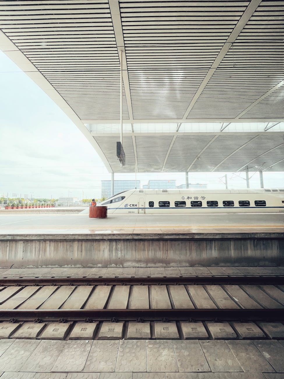
5.3 Train types and classes
Common train prefixes:
Common high-speed classes:
Conventional sleeper trains can save a hotel night, but they require more tolerance for shared spaces, variable toilets, noise, and longer travel times.
5.4 Station procedure
Large Chinese railway stations operate more like airports than small street-side train stations. Expect:
Arrive early at unfamiliar stations. Large stations such as Shanghai Hongqiao, Guangzhou South, Beijing South, Chengdu East, and Chongqing West require substantial walking.
5.5 Luggage
Most passengers carry luggage onto trains. There is no normal airline-style checked baggage process for ordinary trips. Pack so you can lift your own bag and move quickly. Oversized luggage is stressful during holidays and at crowded station transfers.
5.6 Local concerns around rail
For locals, high-speed rail improves life but also creates pressure:
- Beijing–Shanghai.
- Beijing–Xi’an.
- Beijing–Zhengzhou–Wuhan–Guangzhou–Shenzhen.
- Shanghai–Suzhou–Wuxi–Nanjing.
- Shanghai–Hangzhou.
- Guangzhou–Shenzhen–Hong Kong.
- Chengdu–Chongqing.
- Xi’an–Chengdu.
- Guangzhou/Shenzhen–Guilin/Yangshuo.
- Use your passport name exactly.
- Carry the physical passport.
- Leave extra time for manual checks.
- Check the exact station.
- Check the train number and carriage.
- During major holidays, buy early.
- If a passport gate does not work, go to the manual lane.
- G: high-speed, usually fastest.
- D: high-speed or fast EMU services, sometimes slightly slower or more regional.
- C: intercity services.
- Z/T/K: conventional trains, including overnight or slower services.
- No-letter numeric trains: usually conventional.
- Second class: suitable for most travelers.
- First class: more space, useful for longer trips or luggage.
- Business class: premium, expensive, comfortable, useful for business travelers or those with mobility/comfort priorities.
- Arrival at station perimeter.
- Passport/ticket identity check.
- Bag security screening.
- Waiting hall.
- Gate announcement.
- Boarding through gate shortly before departure.
- Platform access.
- Fast boarding by carriage number.
- Holiday ticket shortages.
- Long commutes to outlying high-speed stations.
- Weekend crowding.
- Expensive station-area taxis.
- Elderly relatives needing help with app and ID procedures.
- Regional inequality between cities with frequent high-speed service and places still dependent on buses or conventional rail.
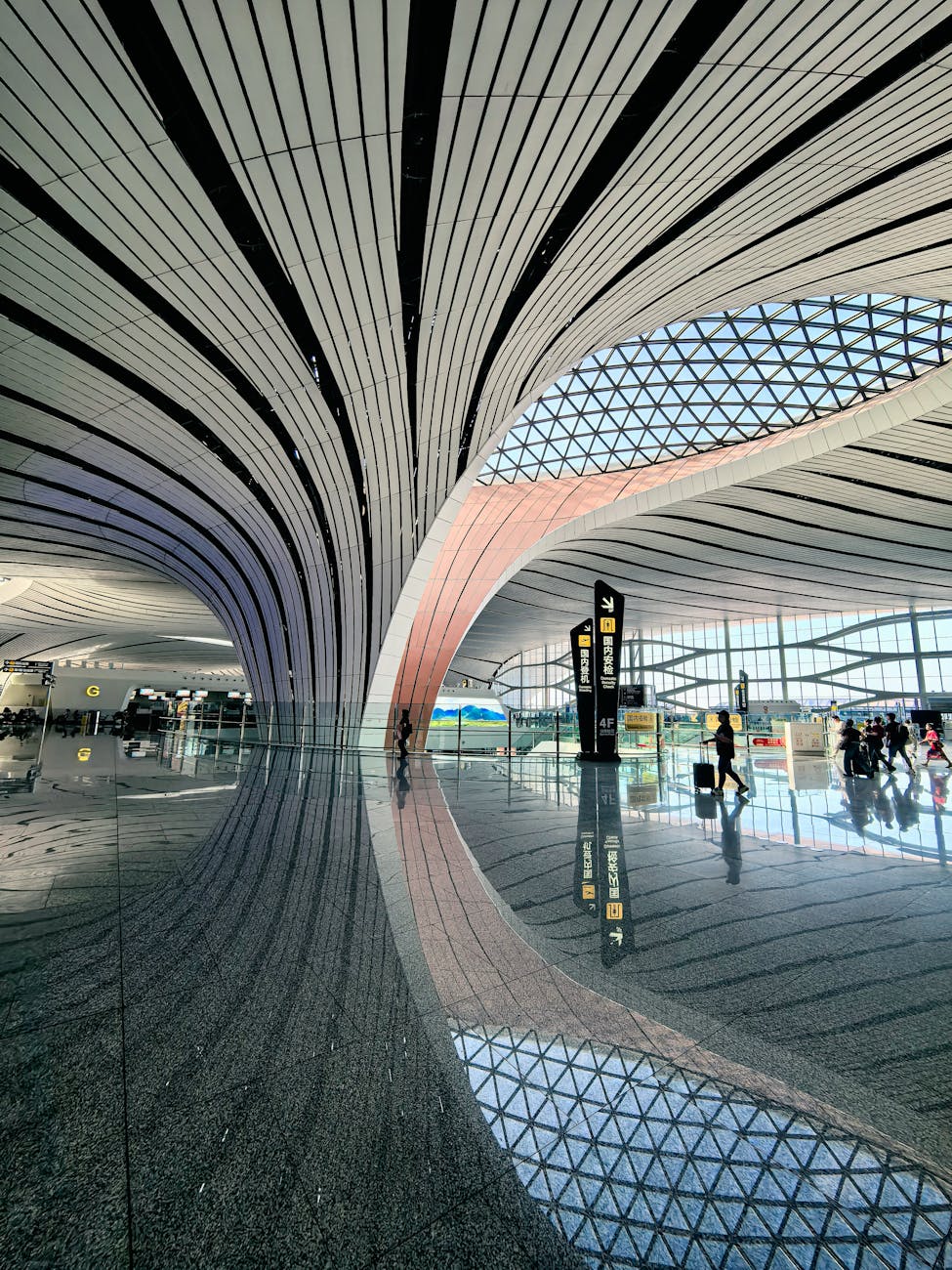
6. Domestic aviation and airport access
China’s airports are modern and busy. Aviation is best when distance is very long, when rail is slow or unavailable, when crossing mountainous or western regions, or when traveling to islands such as Hainan.
General airport rules:
For cities in this paper, airport rail is strongest in Beijing, Shanghai, Guangzhou, Shenzhen, Chengdu, Hangzhou, Chongqing, and Sanya. Guilin and Zhangjiajie rely more heavily on shuttle buses, taxis, and private transfers.
- Check terminal carefully.
- Use the same passport used for booking.
- Confirm whether metro is still running if arriving late.
- Use official taxi ranks or Didi pickup zones.
- Avoid drivers soliciting inside terminals.
- Leave time for domestic security checks.
- Watch rules around batteries, power banks, lighters, liquids, and tools.
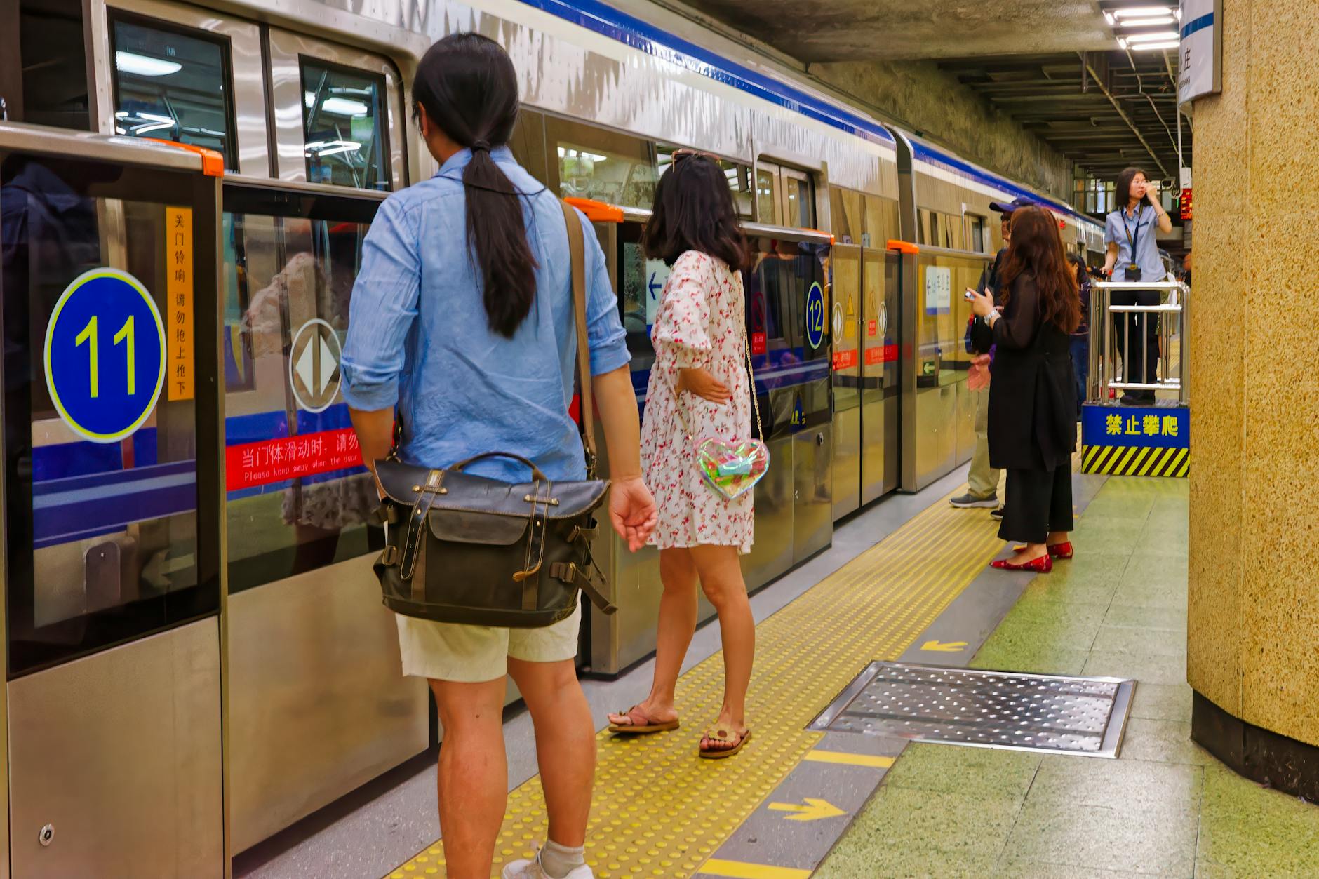
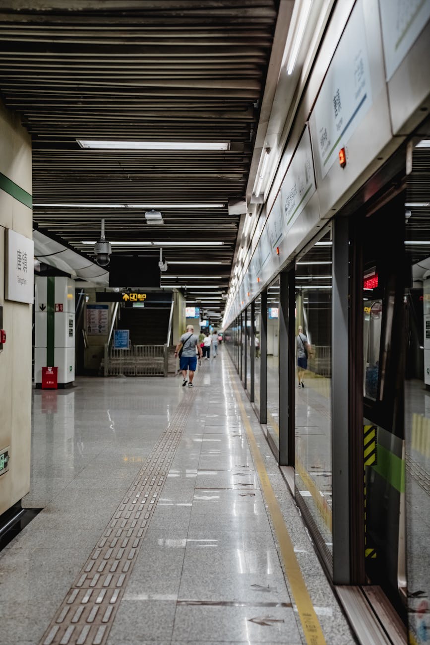
7. Urban metro systems
7.1 Why metros are the visitor default
Large Chinese metros are cheap, frequent, safe, and legible. They usually have bilingual station names and connect the most important urban transport nodes. For visitors, metro is normally better than bus because it is easier to understand and avoids traffic.
7.2 Common metro friction points
Metros are easy, but not frictionless:
7.3 Metro etiquette
Let passengers exit first. Queue where marked. Move away from doors. Keep backpacks low or in front on crowded trains. Give seats to elderly passengers, pregnant passengers, disabled passengers, and small children. Avoid eating on trains. Keep phone volume low.
7.4 Accessibility
New stations are generally better than old ones. Many have elevators, tactile paving, platform screen doors, and priority seating. But real accessibility is still limited by crowds, station size, indirect elevator routes, and sidewalks outside the station. Wheelchair users and travelers with strollers should plan exact station exits and allow extra time.
- Security checks at entrances.
- Rush-hour crowding.
- Long transfer walks.
- City-specific QR code activation.
- Confusing exits.
- Last-train limitations.
- Elevators that exist but are inconvenient.
- Airport or railway transfers that require long walking corridors.
- Tourist sites that are “near” a station but still require a significant walk.
8. Buses, BRT, coaches, and tourist shuttles
8.1 City buses
City buses are cheap and extensive. They are useful for areas not covered by metro, but they are harder for visitors because stop names, directions, and route changes are more Chinese-language dependent.
Use buses when:
Avoid buses when:
8.2 BRT and express buses
Some cities use BRT or express buses as serious mass transit. Guangzhou is the most important example in this paper. BRT can be fast and high-capacity, but platforms, routes, and transfer rules require attention.
8.3 Long-distance coaches
Coaches remain important for counties, scenic areas, mountains, and towns without convenient rail. They are less comfortable than trains but often more direct. Bring motion-sickness medication for mountain roads, especially around Zhangjiajie and western Sichuan-type routes outside Chengdu.
8.4 Tourist shuttles and scenic buses
Tourist shuttles are a major part of Chinese travel. They connect city centers, railway stations, airports, scenic gates, cableways, piers, and resort areas. In Zhangjiajie, scenic buses and cableways are not side details; they are the transport system.
- A map app clearly shows the route.
- You have activated local bus payment.
- You are not carrying heavy luggage.
- The route is direct.
- You are not in a hurry during rush hour.
- You cannot confirm direction.
- Traffic is heavy.
- You are traveling late at night.
- You have luggage or small children.
- The route requires multiple transfers.
9. Taxis and ride-hailing
9.1 Didi
Didi is the dominant ride-hailing platform. It reduces language friction because the destination, route, fare estimate, and driver communication can happen in-app. Didi’s official app listing describes global mobile-number login, international bank-card support, English interface, bilingual messaging, and English customer service.
9.2 Official taxis
Official taxis are useful at airports, hotels, and railway stations. Use official taxi ranks. Avoid people who approach you inside terminals or station halls. Ask for the meter unless a clearly posted fixed fare applies. Keep a receipt if you put luggage in the trunk.
9.3 Pickup zones
Ride-hailing problems in China often happen at the pickup point. Airports, railway stations, malls, exhibition centers, and scenic areas may have designated online ride-hailing zones. The driver may not be allowed to stop at the exact map pin. Follow signs for online car-hailing, ride-hailing, or 网约车.
9.4 When road transport is better than metro
Use taxi, Didi, or private transfer when:
Use metro when:
- You arrive after metro closure.
- You have large luggage.
- You travel with children or elderly relatives.
- The hotel is far from a station.
- Weather is bad.
- The route requires multiple transfers.
- You are going to a scenic gate, pier, or resort.
- Roads are congested.
- You travel light.
- The destination is near a station.
- You want predictable travel time.
- You are moving between major stations or city centers.
10. Private vehicles, rental cars, and driving
10.1 Foreign visitors and driving permission
Foreign visitors cannot treat a foreign license as automatically sufficient for normal driving in mainland China. Shanghai’s official guidance says foreigners who need to drive temporarily in China can apply for a temporary driving permit from traffic police. Beijing Capital Airport also provides temporary driving-permit service guidance for foreign visitors.
Even after obtaining a temporary permit, Beijing’s official FAQ says foreigners with a temporary driving permit may only drive rental cars, not private vehicles. Rules and local practice can vary, so any visitor planning to drive should verify the current requirement in the city of arrival.
10.2 Should visitors rent cars?
Usually, no — not in Beijing, Shanghai, Guangzhou, Shenzhen, Hangzhou, Suzhou, Chengdu, Xi’an, or central Chongqing. Dense traffic, parking scarcity, unfamiliar road rules, app-based parking, toll systems, e-bike flows, and camera enforcement make driving unnecessary and stressful.
A private car or driver can make more sense in:
Even then, a hired driver or private transfer is often easier than self-driving.
10.3 Local driving concerns
Locals deal with:
Private cars are useful for residents but rarely the best tool for a short urban tourist stay.
- Sanya and Hainan resort areas.
- Guilin/Yangshuo countryside routes.
- Zhangjiajie scenic transfers.
- Rural or multi-stop itineraries.
- Family travel with luggage.
- Parking shortages.
- Congestion around schools, hospitals, malls, and stations.
- Plate restrictions in some cities.
- Expensive central parking.
- E-bike and delivery-rider conflicts.
- App-managed parking payments.
- Toll roads and expressway congestion.
- Holiday traffic jams around scenic areas.
12. Ferries, water transport, and scenic boats
Water transport matters locally. Shanghai has Huangpu River ferries. Hangzhou has canal water buses. Guangzhou has Pearl River water transport and cruises. Guilin’s Li River cruise is both transportation and sightseeing. Sanya uses boats for island excursions. Chongqing has river cruises, but the Yangtze River Cableway is now more tourist attraction than practical commuter tool; iChongqing describes it as a tourist spot rather than ordinary public transportation today.
Treat water transport as route-specific. It can be scenic and memorable, but it is not always the fastest way to move.

13. Safety, security, and reliability
Public transport in China is generally safe from a personal-security perspective. Stations are staffed, CCTV is common, and transit spaces are heavily managed. The bigger risks are practical:
The best safety practice is preparation: save addresses, carry the passport on rail days, use official pickup zones, keep the phone charged, and leave buffer time.
- Missing a train because of the wrong station.
- Losing a passport.
- Phone battery failure.
- Payment app lockout.
- Unlicensed taxi touts.
- Ride-hailing pickup confusion.
- Overpacking for rail transfers.
- Heat, typhoon, fog, snow, or mountain weather.
- Holiday crowding.
- Pedestrian conflict with e-bikes and scooters.
14. Accessibility, families, and older travelers
China’s transport infrastructure is modern in many places, but modern does not always mean easy. Stations can be enormous. Elevators may require indirect routing. Crowds can be tiring. Security checks add steps. Sidewalks can be uneven outside stations. Scenic areas may involve buses, cable cars, stairs, steep paths, or long walks.
For families:
For older travelers:
For wheelchair users, research specific station exits and hotel access before booking. Metro maps may show accessibility, but the practical route from platform to street can still be long.
- Use metro for simple urban routes.
- Avoid rush hour with children and strollers.
- Use Didi/taxi for luggage and late nights.
- Book train seats early so the group sits together.
- Consider first class on long high-speed rail trips.
- Use private transfers in Guilin, Zhangjiajie, and Sanya if budget allows.
- Avoid hotels requiring complicated transfers.
- Keep daily routes geographically compact.
- Use elevators, taxis, and private transfers without guilt.
- Do not rely on standing-room metro rides at peak hours.
- Keep paper or screenshot backups of hotel addresses.
15. Holidays, weather, and disruption planning
China’s transport system becomes heavily stressed during national holidays and seasonal peaks:
During peak periods, book rail early, avoid tight transfers, and do not assume taxi availability near scenic spots.
- Spring Festival / Chinese New Year: the largest family travel period.
- National Day Golden Week around October 1: intense tourist and family travel.
- May Day holiday: short but extremely busy.
- Summer school holidays: family travel and heat.
- Canton Fair periods in Guangzhou: business-travel surges.
- Typhoon season: relevant for Shanghai, Hangzhou, Guangzhou, Shenzhen, and Sanya.
- Mountain fog/rain: relevant for Chongqing and Zhangjiajie.
- Winter cold/snow: relevant for Beijing and northern connections.
16. National strategy by traveler type
First-time urban visitor
Use high-speed rail between cities, metro inside cities, and Didi/taxi for luggage and late nights. Stay near a metro interchange.
Business traveler
Use high-speed rail for major corridor travel, Didi/taxi for meetings, and airport rail where it clearly beats road traffic. Leave extra time for station walking.
Family traveler
Use trains for intercity travel, taxis/private transfers for airports and scenic sites, and metro only on simple routes outside rush hour.
Budget traveler
Use second-class high-speed rail, conventional rail where reasonable, metro, city buses when routes are clear, and hostels/hotels near transit.
Scenic/nature traveler
Use rail or flights to gateway cities, then buses, scenic shuttles, cable cars, and private transfers. The hard part is usually the last mile.
Long-stay foreign resident
Set up Alipay, WeChat Pay, Amap/Baidu, Didi, local transit cards, and neighborhood bus knowledge. Learn the commute pattern of your city rather than treating every trip like a tourist route.
System profile
Beijing is China’s political capital and one of the world’s largest urban transport systems. It has a huge subway, extensive buses, two major airports, multiple major railway stations, ring roads, taxis, ride-hailing, airport express rail, suburban rail, and tourist routes to Great Wall sites. The city is geographically large and administratively complex. Distances are often longer than visitors expect.
The main rule is: use the subway when possible, use Didi/taxi for door-to-door gaps, and do not drive unless you are a resident with a specific need.
Airports
Beijing has two major airports:
PEK is served by the Capital Airport Express. PKX is served by the Daxing Airport Express and other road/rail services. Beijing’s official foreigner service pages also promote the Beijing Pass as a travel card for overseas visitors and describe airport service counters.
Airport strategy:
- Beijing Capital International Airport (PEK): northeast of the city.
- Beijing Daxing International Airport (PKX): south of the city.
- Use airport rail if you travel light and arrive during operating hours.
- Use taxi/Didi for late arrivals, luggage, children, or hotels far from metro.
- Check whether PEK or PKX is better for your hotel; they are on opposite sides of the city.
- Avoid unofficial drivers soliciting inside airport terminals.
Railway stations
Important Beijing stations include:
Never assume all Beijing trains use the same station.
- Beijing South: major high-speed station for Shanghai, Tianjin, Nanjing, and eastern/southern routes.
- Beijing West: major station for Xi’an, Zhengzhou, Wuhan, Guangzhou, and western/southern routes.
- Beijing Railway Station: older central station for some conventional and regional services.
- Beijing Chaoyang: important for northeastern routes.
- Beijing Fengtai: growing rail hub.
- Beijing North / Qinghe: useful for some northern and Zhangjiakou-area services.
Subway, buses, and payment
The Beijing Subway is the visitor’s primary tool. It connects Tiananmen/Forbidden City area, Temple of Heaven, Summer Palace, Olympic Park, hutongs, railway stations, business districts, and airport express lines.
Beijing’s official subway ticket guidance lists several visitor-friendly options, including Beijing Pass, Alipay metro QR codes, ticket vending machines, and manned ticket counters. The Beijing Pass is especially useful for visitors who want a physical card; official Beijing guidance describes it as a rechargeable card for overseas visitors that can be used across urban rail, suburban rail, buses, taxis, and other participating services.
Buses are extensive but harder for visitors. They are useful for outer parks, hutong edges, university districts, and some Great Wall transfer points. For most short visitors, subway plus Didi is simpler.
Great Wall and outer attractions
Great Wall sections are outside the urban core. Badaling is more public-transport friendly than many sections. Mutianyu, Jinshanling, and Simatai often require tourist buses, private cars, or organized transfers. Treat a Great Wall trip as a regional excursion, not a casual subway ride.
Private vehicles and local concerns
Beijing residents deal with congestion, parking shortages, ring-road bottlenecks, long suburban commutes, school-run traffic, and vehicle restrictions. For visitors, driving is rarely sensible. Taxis and Didi are useful, but pickup points near Tiananmen, the Forbidden City, railway stations, and airports can be controlled or distant.
What is unique and important
Beijing is large, security-conscious, and station-heavy. The correct airport, station, subway exit, and attraction entrance matter. Build days by district. Do not plan an itinerary that forces you to crisscross the city repeatedly.
System profile
Shanghai is China’s most internationally legible transport city. It has a vast metro, two major airports, the Pudong Maglev, the Airport Link Line, large railway hubs, Huangpu River ferries, taxis, Didi, shared bikes, and dense pedestrian districts. It is often easier for first-time visitors than Beijing because central attractions cluster along metro lines and foreign-payment support is relatively strong.
Airports
Shanghai has two major airports:
Transport options include Metro Line 2, the Maglev, the Airport Link Line, airport buses, taxis, and Didi. Shanghai Airport’s official site identifies the Airport Link Line as a rail link connecting Pudong Airport and Hongqiao Airport. Shanghai’s city portal reported that the line cut the journey between the two airport areas to about 40 minutes.
The Maglev is fast and iconic, but it only links Pudong Airport with Longyang Road. Shanghai Airport’s official page lists the Maglev one-way fare as CNY 50 and round trip as CNY 80. It is excellent if it fits your route; otherwise Metro Line 2, Airport Link Line, taxi, or Didi may be more practical.
- Pudong International Airport (PVG): main international gateway.
- Hongqiao Airport (SHA): mostly domestic and regional, integrated with Hongqiao Railway Station.
Railway stations
Important stations:
Hongqiao is efficient but enormous. Build in walking time.
- Shanghai Hongqiao Railway Station: giant HSR hub integrated with Hongqiao Airport.
- Shanghai Railway Station: central and convenient for many routes.
- Shanghai South: useful for some conventional and regional routes.
- Shanghai West: route-specific.
Metro, ferries, and payment
Shanghai Metro is the visitor default. Shanghai’s official metro guide lists payment and ticketing options including Metro Daduhui, single-journey tickets, Shanghai Public Transport Card, Suishenxing, one-day passes, three-day passes, and Maglev-plus-metro passes. Shanghai also expanded foreign bank-card payment options across metro, buses, and ferries in 2024.
Huangpu River ferries can be practical and scenic, but they are route-specific. The Bund, Lujiazui, Nanjing Road, People’s Square, Xintiandi, and the Former French Concession are walkable in sections, but distances remain large.
Local concerns
Shanghai residents deal with peak metro crowding, Line 2 airport corridor demand, expensive central parking, rain and typhoon disruption, event traffic, and long commutes from outer districts. The city is relatively visitor-friendly, but local life still depends on juggling metro QR, transport cards, ride-hailing, bike parking, and compound access.
What is unique and important
Shanghai is the best Chinese city for experiencing multimodal urban transport: metro, airport rail, maglev, ferries, shared bikes, high-speed rail, and foreign-card transit access all coexist. The mistake is assuming the most famous transport option is always the most useful. The Maglev is fun; the metro is usually the workhorse.
System profile
Xi’an is an ancient capital with a fast-growing metro network, a major high-speed rail station, one large airport, buses, taxis, ride-hailing, and essential tourist transport to sites outside the center. The historic core is compact compared with Beijing or Shanghai, but the airport, North Railway Station, and Terracotta Army are not central.
Airport and rail
Xi’an Xianyang International Airport (XIY) is northwest of the city. Metro Line 14 is the key rail link between the airport area and the city’s rail network, including Xi’an North Railway Station.
Xi’an North Railway Station is the main high-speed rail hub. Xi’an Railway Station remains useful for conventional and some regional services.
Metro and buses
Xi’an Metro is the easiest way to cover the Bell Tower, city wall areas, Giant Wild Goose Pagoda area, North Railway Station, airport transfers, and many urban districts. Buses are useful for last-mile travel and some tourist routes, but they require more confidence with Chinese-language navigation.
Terracotta Army transport
The Terracotta Army is outside central Xi’an in Lintong. Public transport is possible but not effortless. Current travel guidance says visitors can take Metro Line 9 to Huaqing Pool Station, then transfer to Lintong Bus 602 or Lintong Tourist Bus 613.
Practical options:
- Metro plus bus for budget travelers.
- Tourist bus or organized tour for simplicity.
- Didi/private transfer for families, early starts, or tight schedules.
- Avoid unofficial touts near stations.
Old city movement
The Bell Tower, Drum Tower, Muslim Quarter, and city wall are walkable in pieces, but pedestrian flows can be heavy. Cycling on the city wall is a tourist experience, not normal transport. Taxis inside the old core may be slowed by congestion and one-way streets.
Local concerns
Xi’an locals face growing metro demand, tourism pressure in the old core, road congestion around the city wall, airport distance, and suburban commuting from expanding districts. The heritage layout shapes transport choices more than visitors expect.
What is unique and important
Xi’an is a heritage city with modern rail expansion. The key mistake is treating “Xi’an” as one compact attraction zone. The airport, North Railway Station, old city, and Terracotta Army are separate transport problems.
System profile
Chengdu is the transport capital of Sichuan and a gateway to western China. It has a large metro network, two airports, multiple rail stations, buses, taxis, ride-hailing, and major tourist flows to the Panda Base, Dujiangyan, Mount Qingcheng, Leshan, Emei, and western Sichuan.
The city is broad and relatively flat, but metropolitan distances are large. Metro is the backbone; Didi and taxis fill food, hotel, and attraction gaps.
Airports
Chengdu has two major airports:
Metro Line 18 is the key rail link for Tianfu Airport, while Shuangliu is served by metro connections including Line 10. Tianfu Airport distance is one of the biggest visitor planning issues in Chengdu.
- Chengdu Shuangliu International Airport (CTU): closer to the older urban area.
- Chengdu Tianfu International Airport (TFU): farther southeast and much more distant from many central hotels.
Railway stations
Check the exact station. Chengdu East and Chengdu South are not interchangeable.
- Chengdu East: main high-speed rail hub.
- Chengdu South: useful for some rail and airport connections.
- Chengdu West/North and other stations: route-dependent.
Metro, buses, and Panda Base
Chengdu Metro covers Tianfu Square, Chunxi Road, East Railway Station, South Railway Station, airport links, and many residential districts. Buses cover gaps but are less convenient for visitors.
For the Chengdu Research Base of Giant Panda Breeding, official guidance says visitors can take Metro Line 3 to Panda Avenue Station and transfer to Shuttle Bus 408 for the South Gate.
Go early for pandas. Use Didi/taxi if traveling with children or if you want to reduce transfer stress.
Regional travel
Chengdu is a base for:
Rail is strong for many regional trips, but mountain destinations often require buses, tours, or private vehicles beyond the rail station.
- Dujiangyan and Mount Qingcheng.
- Leshan Giant Buddha.
- Emei Shan.
- Jiuzhaigou and western Sichuan routes.
- Chongqing by high-speed rail.
Local concerns
Residents deal with growing commute distances, ring-road congestion, airport split between CTU and TFU, food-district parking shortages, and large weekend leisure flows. E-bikes and scooters are common. Rain and air-quality conditions can affect comfort.
What is unique and important
Chengdu is both a comfortable lifestyle city and a regional launchpad. Metro handles the city; rail and airports handle the region; taxis and Didi handle the food-and-neighborhood gaps. Do not underestimate Tianfu Airport distance.
System profile
Guangzhou is the transport center of the western Pearl River Delta. It has a large metro, dense buses, BRT, intercity rail, high-speed rail, Baiyun Airport, Pearl River water transport, taxis, ride-hailing, and major event flows from the Canton Fair.
Airport and railway stations
Guangzhou Baiyun International Airport (CAN) is north of the city. Guangzhou’s English service portal describes airport transport options including taxis, airport buses, e-hailing pickup arrangements, and terminal transfers.
Important stations:
Guangzhou South requires generous walking and transfer time.
- Guangzhou South: giant high-speed rail hub for Shenzhen, Hong Kong, Zhuhai, Guilin, Beijing, Wuhan, and many other routes.
- Guangzhou East: useful for some regional and intercity services.
- Guangzhou Railway Station / Guangzhou Baiyun Station: route-dependent.
Metro, BRT, buses, and water transport
Guangzhou Metro is the primary visitor tool. It reaches most central districts, railway hubs, Baiyun Airport, and Pazhou/Canton Fair areas. Guangzhou Metro began supporting foreign contactless bank-card tap-to-ride on designated gates in October 2025.
BRT is a major local feature, especially along key corridors. It is useful but more complex for visitors than metro.
Pearl River ferries and cruises are route-specific. They can be scenic and useful, but they are not general substitutes for metro.
Canton Fair
The Canton Fair changes Guangzhou’s transport pattern. Official city guidance identifies Metro Line 8 stations such as Xingang East and Pazhou as key access points for the Canton Fair complex.
During fair periods:
- Stay near Line 8, a direct shuttle hotel, or a simple transfer.
- Expect heavy metro and taxi demand.
- Book hotels early.
- Leave time for exhibition-hall pickup chaos.
Local concerns
Guangzhou locals manage humid heat, heavy rain, typhoon risk, trade-fair surges, metro crowding, cross-city commutes with Foshan and Dongguan, and road congestion. The city is strong because it has multiple modes, but the Pearl River Delta scale can make “nearby” destinations feel far.
What is unique and important
Guangzhou is a regional transport machine, not just a city. Its metro is essential, but its BRT, intercity links, Canton Fair flows, and Pearl River Delta context make it more complex than the tourist core suggests.
System profile
Shenzhen is a modern, dense, technology-driven border city. Its transport system is metro-oriented, airport-linked, cross-border, and tightly connected to Hong Kong. It has a large metro, Bao’an Airport, multiple rail stations, border checkpoints, ferries, buses, taxis, Didi, and shared bikes.
Airport
Shenzhen Bao’an International Airport (SZX) is connected by Metro Line 11. Shenzhen Airport’s official English page identifies Line 11 as the airport express metro line and lists the airport-related stations.
Line 11 is fast and useful for Futian, Nanshan, Qianhai, and western/central districts. Taxi/Didi is better for late arrivals or hotels away from the line.
Rail stations and Hong Kong links
Important Shenzhen stations:
Hong Kong connections define Shenzhen’s transport identity. Hong Kong MTR’s cross-boundary page describes East Rail Line travel via Lo Wu or Lok Ma Chau and High Speed Rail services from Hong Kong West Kowloon to mainland stations without interchange. Shenzhen’s 2026 border-crossing guide summarizes major checkpoints such as Luohu and Futian, emphasizing their role in cross-border movement.
- Shenzhen North: major high-speed rail hub.
- Futian: central underground high-speed rail station with links toward Hong Kong West Kowloon and Guangzhou/Shenzhen corridor.
- Shenzhen Railway Station / Luohu: near the Luohu border crossing.
- Shenzhen East/West and other stations: route-dependent.
Metro, buses, and payment
Shenzhen Metro is the default. It is modern, bilingual, and tied to business districts, ports, airport, and rail stations. Buses fill outer-district gaps. Didi/taxis are useful for late nights, hilly neighborhoods, or industrial areas beyond easy metro reach.
Shenzhen is also important for cross-border payment products. The Hu Tong Xing card, described by Shenzhen official guidance, combines Shenzhen Tong and Octopus functions and can work through China T-Union in many mainland cities while also functioning in Hong Kong’s Octopus system.
Border behavior
Do not treat Hong Kong and Shenzhen like two stops on one domestic subway. They are separate jurisdictions with immigration, customs, payment systems, and transport rules.
Practical rules:
- Check visa and entry status.
- Confirm checkpoint operating hours.
- Allow time for immigration.
- Use Luohu/Lo Wu, Futian/Lok Ma Chau, Shenzhen Bay, or HSR depending on destination.
- Do not assume taxis can cross.
- Keep payment options for both mainland China and Hong Kong.
Local concerns
Shenzhen residents deal with long linear commutes, high housing costs, cross-border weekend flows, tech-campus work patterns, busy airport corridors, e-bike/delivery traffic, and road congestion around business districts. The metro is excellent, but the city’s speed of growth creates constant pressure.
What is unique and important
Shenzhen is defined by borders, technology, and speed. It is one of the easiest mainland cities for metro travel and one of the easiest to misunderstand if you forget that Hong Kong is legally and operationally separate.
System profile
Hangzhou is a scenic, tech-oriented city with a large metro, Xiaoshan International Airport, high-speed rail, buses, water buses, bike culture, taxis, Didi, and heavy tourist flows around West Lake. It is calmer than Shanghai but still geographically large.
Airport and rail
Hangzhou Xiaoshan International Airport (HGH) is served by metro lines. The airport’s official English guide says Metro Lines 1, 7, and 19 are open at the airport.
Important railway stations:
Station choice matters because Hangzhou East and Hangzhou West serve different urban geographies.
- Hangzhou East: main high-speed rail hub.
- Hangzhou West: growing hub for western and northwestern areas.
- Hangzhou Railway Station: central but route-dependent.
- Hangzhou South and others: route-specific.
Metro, bikes, buses, and water buses
Hangzhou Metro connects the airport, railway stations, West Lake vicinity, Qianjiang New City, tech districts, and residential zones. Buses cover West Lake edges, hills, temples, wetlands, and outer districts.
Hangzhou’s bike culture is nationally important. Overseas users have been able to scan and ride Hangzhou’s public shared bikes through Alipay, according to local reporting.
Hangzhou also has canal water buses. Official Hangzhou reporting describes water-bus services such as the No. 7 water bus as part of the city’s canal transport and tourism experience.
West Lake movement
West Lake is best experienced by walking, biking, short buses, and occasional taxis. Roads around the lake can be crowded, especially on weekends and holidays. Do not plan to circle the entire lake by taxi during peak tourist periods.
Local concerns
Hangzhou locals deal with tourism pressure around West Lake, tech-district commuting, rainy weather, airport distance, busy Hangzhou East station flows, and bike/e-bike parking management. Weekend scenic-area traffic can be heavy.
What is unique and important
Hangzhou combines metro modernization with lake, canal, and bike mobility. Use metro for long movement, walking/bikes for West Lake, and Didi/taxi when pickups are simple.
System profile
Suzhou is a heritage, garden, canal, industrial, and commuter city west of Shanghai. It has a growing metro, high-speed rail access, buses, taxis, Didi, canal tourism, and no major international airport of its own. Its transport system is tied closely to Shanghai, Wuxi, Kunshan, and the broader Yangtze River Delta.
Getting to Suzhou
Rail is the easiest way to reach Suzhou. Suzhou’s official English transport page emphasizes the city’s strong rail access and also notes airport links through nearby airports, including Sunan Shuofang, Shanghai Hongqiao, and Shanghai Pudong via city terminals and connecting transport.
Practical airport strategy:
- From overseas, fly to Shanghai Pudong, Shanghai Hongqiao, or nearby Wuxi if suitable.
- From Shanghai Hongqiao, high-speed rail to Suzhou is usually efficient.
- From Pudong, allow more time because the airport is farther from Suzhou.
Railway stations
Important stations:
For garden tourism, Suzhou Railway Station is often more convenient than Suzhou North.
- Suzhou Railway Station: close to the old city and useful for many visitors.
- Suzhou North: high-speed station farther from the old core.
- Suzhou Industrial Park: useful for Jinji Lake and business districts.
- Suzhou New District: route-dependent.
Metro, buses, and old-town transport
Suzhou Metro is increasingly useful for the old city, railway station, Suzhou Industrial Park, Jinji Lake, Tongli direction, and connections toward Kunshan/Shanghai. Suzhou Metro Line 11 connects with Shanghai Metro Line 11 at Huaqiao, creating a metro-style link between Suzhou and Shanghai.
For many travelers, high-speed rail is still faster than riding metro all the way between Shanghai and Suzhou. Use the metro connection for specific corridor travel, not because it is always the fastest.
Buses and taxis are useful for gardens, canal areas, and old-town lanes. Walking is pleasant but slow because bridges, canals, walls, and tourist crowds shape routes.
Local concerns
Suzhou locals live with the tension between preserved old city and modern industrial economy. Commuters may travel between the old city, Suzhou Industrial Park, Kunshan, Shanghai, and Wuxi. Tourism creates congestion around Pingjiang Road, Shantang Street, Humble Administrator’s Garden, and canal areas. Parking in heritage zones is limited.
What is unique and important
Suzhou is a rail-access city rather than an airport city. The key transport decisions are which railway station to use, how close your hotel is to the old city, and how much walking you can tolerate around gardens and canals.
System profile
Chongqing is one of China’s most physically unusual transport cities. It is mountainous, vertical, river-cut, and enormous. Its rail transit includes metro and monorail lines, and the city is famous for Line 2 at Liziba, where the train passes through a building. Roads can be indirect because elevation, tunnels, bridges, rivers, and cliffs shape every route.
The main rule is: do not trust flat-map distance. A destination that looks close may be separated by stairs, hills, or a river crossing.
Airport and rail
Chongqing Jiangbei International Airport (CKG) is served by Chongqing Rail Transit lines including Line 3 and Line 10; current transport guides describe both lines as key airport links.
Important stations:
Station-square choice matters, especially at Chongqing North.
- Chongqing North: major rail hub; square orientation can be confusing.
- Chongqing West: major high-speed rail station.
- Shapingba: useful for some Chengdu–Chongqing services and urban access.
- Chongqing East and others: route-dependent.
Rail transit, monorail, and vertical movement
Chongqing Rail Transit is the backbone. The official English Chongqing Rail Transit site provides line, fare, and transfer information. The system’s monorail lines are both practical and iconic. Liziba Station on Line 2 is a functioning station and tourist sight; travel guides describe its famous train-through-building feature.
The Yangtze River Cableway is now mainly a tourist experience rather than everyday transport.
Buses, taxis, and walking
Buses cover many rail gaps, but terrain makes routes harder to understand. Taxis and Didi are useful for food districts, hillside hotels, late nights, and cross-river trips. Walking can be rewarding but physically demanding.
Local concerns
Residents deal with steep walks, summer heat, fog, rain, crowded rail lines, bridge congestion, deep stations, and complicated transfers. E-bikes are less universally easy than in flat cities. Locals know vertical shortcuts that apps may not explain.
What is unique and important
Chongqing is a three-dimensional city. Station exits, building entrances, roads, and sidewalks may be on different levels. Choose hotels carefully and budget more time for walking than the map suggests.
System profile
Guilin is a scenic gateway rather than a metro city. It is known for karst landscapes, the Li River, Yangshuo, Longji Rice Terraces, caves, and countryside routes. Transport is built around airport access, high-speed rail, buses, taxis, private transfers, river cruises, bikes, e-bikes, and sightseeing routes. There is no metro system for normal visitor use; contemporary travel guides continue to describe movement by buses, taxis, bikes, cruises, and road transfers.
Airport and rail
Guilin Liangjiang International Airport (KWL) is outside the city. Visit Guilin’s airport-shuttle guide describes shuttle bus routes from the airport to Guilin City and Yangshuo.
Important stations:
Station choice matters greatly. Guilin West or Yangshuo Station can create significant last-mile transfers.
- Guilin Railway Station: central.
- Guilin North: important for high-speed routes.
- Guilin West: high-speed station farther from the center.
- Yangshuo Station: useful for Yangshuo, but not in the middle of Yangshuo town.
City buses, taxis, and bikes
Guilin city buses are cheap. TravelChinaGuide notes that many Guilin buses report stops in Chinese and English and that ordinary bus fares are low. Taxis and Didi are convenient for central Guilin and station transfers. Bikes and e-bikes are popular in Yangshuo and countryside areas, but traffic and road conditions require caution.
Li River, Yangshuo, and Longji
The Li River cruise is both sightseeing and transportation. China Discovery describes the Guilin–Yangshuo distance as about 65 kilometers and the Li River cruise route as an 83-kilometer waterway that typically takes around 4.5 hours as a tourist cruise.
Other options include:
Longji Rice Terraces require road travel and more planning. Weather can affect comfort and timing.
- Bus from Guilin to Yangshuo.
- High-speed rail to Yangshuo Station plus road transfer.
- Taxi/private car.
- Airport shuttle to Yangshuo.
Local concerns
Residents depend on buses, e-bikes, cars, taxis, and tourism transport. Tourism creates peak flows to river piers, Yangshuo, Longji, and central sights. Outer counties remain road-dependent.
What is unique and important
Guilin is a last-mile planning city. The challenge is connecting airport, rail station, pier, Yangshuo hotel, countryside route, and terrace village without wasting half the trip.
System profile
Zhangjiajie is a mountain and scenic-area transport city. It does not function like a major metro city. Travel depends on airport and rail access, buses to Wulingyuan and scenic gates, taxis/private transfers, cable cars, internal scenic buses, elevators, and route planning inside national parks.
Airport and rail
Zhangjiajie Hehua International Airport (DYG) is close to the urban area. TravelChinaGuide says city bus routes 401 and 402, also described as Bus No. 4 loop routes, pass the airport, city center, and Tianmen Mountain cable car lower station.
Rail access includes Zhangjiajie Railway Station and Zhangjiajie West high-speed station. Check which station your train uses and whether your hotel is in Zhangjiajie city or Wulingyuan.
Tourist buses and Wulingyuan
The main tourist geography is split among:
Hunan provincial reporting says Zhangjiajie launched six tourist bus lines in 2024 linking downtown areas with scenic spots including Wulingyuan, Zhangjiajie National Forest Park, Zhangjiajie Grand Canyon, and Tianzi Mountain.
- Zhangjiajie city center and Tianmen Mountain.
- Wulingyuan and Zhangjiajie National Forest Park.
- Zhangjiajie Grand Canyon and Glass Bridge.
- Tianzi Mountain and other scenic areas.
Internal scenic transport
Zhangjiajie National Forest Park uses internal shuttle buses and other scenic transport. Discover Zhangjiajie notes that internal shuttle buses are provided for visitors and that buses generally run during daytime park hours, with last buses around the early evening depending on conditions.
Other components include:
Tianmen Mountain ticketing and route choices can also be complex; current travel guidance describes route options such as cableway and shuttle combinations.
- Tianmen Mountain cableway.
- Bailong Elevator.
- Tianzi Mountain cableway.
- Yangjiajie cableway.
- Ten-Mile Gallery mini-train.
- Park shuttle buses.
Hotel strategy
Choose lodging based on transport:
- Stay in Wulingyuan for multiple days in Zhangjiajie National Forest Park.
- Stay in Zhangjiajie city for Tianmen Mountain, airport/rail convenience, or short stays.
- Use private transfer for late arrivals or luggage-heavy moves to Wulingyuan.
- Do not assume all scenic spots are close to each other.
Local concerns
Residents deal with tourism seasonality, road constraints, scenic-area crowding, airport/rail peaks, weather disruption, and employment flows tied to the tourism industry. Transport supply may feel strong in peak tourist corridors but weak in ordinary local areas.
What is unique and important
In Zhangjiajie, transport is part of the attraction. Cableways, elevators, mountain roads, internal buses, and scenic gates define the trip. Overplanning is not excessive here; it is how you avoid losing a day.
System profile
Sanya is a tropical resort city on Hainan Island. It has an airport, Hainan ring high-speed rail, buses, taxis, Didi, hotel shuttles, tourist buses, boats, and car/driver services. It does not have a metro. Distances between bays are larger than many visitors expect.
The main rule is: choose your bay carefully because transport follows the coastline. Sanya Bay, Dadonghai, Yalong Bay, Haitang Bay, city center, the airport, and train stations are separate travel zones.
Airport and rail
Sanya Phoenix International Airport (SYX) is close to Sanya Bay. The airport’s official English site lists airport bus boarding information and fare details for Airport Bus Line 1. Another official airport page says Fenghuangjichang Station of the Hainan Ring High-Speed Railway is connected with the airport terminal area.
The Hainan ring high-speed railway is useful for travel to Haikou, Qionghai, Wanning, Lingshui, and other island destinations.
Buses, taxis, Didi, and hotel shuttles
Visit Sanya’s public-transport guide describes direct airport bus services to the city center and major bay areas and notes that many upscale hotels provide complimentary shuttle buses in Sanya Bay, Yalong Bay, and Haitang Bay.
City buses are cheap and useful for long coastal routes, but taxis/Didi are more convenient for families, beach gear, late nights, and resort hotels. Many resorts are not pedestrian-friendly outside their immediate beachfront area.
Rental cars and private drivers
Sanya is one of the Chinese destinations where a car or private driver can make sense. A driver is useful for families staying in resort areas or visiting Nanshan, Haitang Bay, Wuzhizhou Island ferry points, Yanoda, or remote beaches. Self-driving still requires proper Chinese temporary driving permission, so many visitors should hire a driver or use Didi instead.
Beaches and island trips
Beach transport depends on the destination:
- Sanya Bay: airport access, long waterfront, sunsets.
- Dadonghai: closer to city and nightlife.
- Yalong Bay: resort beach zone.
- Haitang Bay: high-end resorts, Atlantis, duty-free shopping, farther from the city.
- Wuzhizhou Island: ferry logistics.
- Nanshan and Tianya Haijiao: road/bus/taxi excursions west of the city.
Local concerns
Residents deal with tourism traffic, resort-zone commuting, airport and station flows, typhoon-season disruption, beach parking, seasonal labor movement, and heavy dependence on road transport. Hotel shuttles help tourists but do not necessarily serve local commuting needs.
What is unique and important
Sanya is China’s resort-transport case. Metro habits from Shanghai or Beijing do not apply. The visitor’s success depends on bay selection, airport/rail connection, hotel shuttle availability, and realistic taxi/bus planning along a spread-out coastline.
Easiest cities for first-time public transport users
Shanghai, Shenzhen, Beijing, Guangzhou, Chengdu, Hangzhou, and Xi’an are easiest because metro systems are strong and bilingual signage is common. Shanghai is the most foreign-payment-friendly overall; Shenzhen is very modern and metro-oriented; Beijing is excellent but large and security-heavy.
Cities where station choice matters most
Beijing, Shanghai, Guangzhou, Chengdu, Hangzhou, Suzhou, Chongqing, and Guilin require careful station selection. A wrong station can add 30 to 90 minutes.
Cities where last-mile planning matters most
Guilin, Zhangjiajie, Sanya, Chongqing, and Suzhou require the most last-mile planning. Scenic gates, bays, hills, canals, piers, and station distances shape the trip.
Best cities for metro-centered travel
- Shanghai.
- Beijing.
- Shenzhen.
- Guangzhou.
- Chengdu.
- Hangzhou.
- Xi’an.
- Suzhou.
- Chongqing, with the warning that terrain makes walking harder.
Cities where taxis/private transfers matter more
- Zhangjiajie.
- Guilin/Yangshuo/Longji.
- Sanya.
- Great Wall trips from Beijing.
- Chengdu regional mountain trips.
- Terracotta Army trips from Xi’an if traveling with family or limited time.
Cities where a private car or driver is most defensible
Self-driving should still be treated cautiously because of licensing, language, parking, and traffic conditions.
- Sanya and Hainan resort areas.
- Guilin countryside and Longji routes.
- Zhangjiajie scenic transfers.
- Some Chengdu regional mountain trips.
Cities where visitors should avoid car rental for normal sightseeing
The best way to travel in China is not to master every bus route or app feature. It is to use the strongest layer for each part of the trip: high-speed rail for city-to-city, metro for large-city movement, ride-hailing for complicated urban gaps, and private/scenic transport where geography demands it.
: Xinhua, “China's high-speed railway network exceeds 50,000 km,” Dec. 26, 2025, https://english.news.cn/20251226/01e2f8058ba84c5c853ed6bd2375dac1/c.html
: The State Council of the People’s Republic of China / Xinhua, “China railways handle nearly 4.59b passenger trips in 2025,” Jan. 8, 2026, https://english.www.gov.cn/archive/statistics/202601/08/content_WS695f6cdec6d00ca5f9a087c1.html
: China Railway 12306 English FAQ, “Valid ID documents for ticket purchase,” https://www.12306.cn/en/faq.html
: Beijing Municipal Government foreigner rail guidance, “How to verify identity on 12306,” https://wb.beijing.gov.cn/home/index/wsjx/202401/t20240115_3535596.html
: U.S. Department of State, China Travel Advisory and country information, payment note, https://travel.state.gov/en/international-travel/travel-advisories/china.html
: Hangzhou official English portal, “Mobile payment guide for overseas travelers,” Apr. 10, 2024, https://www.ehangzhou.gov.cn/2024-04/10/c_289454.htm
: Meet in Shanghai, “Gaode Maps launches China’s first English map for overseas users,” Jan. 2025, https://www.meet-in-shanghai.net/en/news/gaode-maps-launches-chinas-first-english-map-for-overseas-users-600989/
: People’s Daily Online, “Amap launches multilingual version for overseas users,” July 2025, https://en.people.cn/n3/2025/0714/c90000-20339734.html
: Apple App Store listing, “DiDi China - Ride Hailing,” https://apps.apple.com/us/app/didi-china-ride-hailing/id554499054
: Shenzhen Nanshan official English news, “China T-union logo card can be used in Shenzhen,” https://www.szns.gov.cn/english/news/latestnews/content/post_11241062.html
: Shanghai Municipal Government English portal, “Shanghai public transport accepts foreign bank cards,” Apr. 22, 2024, https://english.shanghai.gov.cn/en-Latest-WhatsNew/20240422/5251c321845b4a488723bb51dd23adc2.html
: Beijing Municipal Government, “Beijing subway supports tap-and-go with overseas bank cards,” Aug. 2025, https://wb.beijing.gov.cn/en/express/202508/t20250828_4186027.html
: Guangzhou Municipal Government English portal, “Guangzhou Metro begins accepting overseas contactless bank cards,” Oct. 2025, https://www.eguangzhou.gov.cn/gzservice/content/post_39343.html
: Shanghai Municipal Government English portal, “How foreigners can apply for temporary driving permits,” Dec. 12, 2024, https://english.shanghai.gov.cn/en-Transportation/20241212/bd0bcbb71e234bf1807d808490a5fa4a.html
: Beijing Capital International Airport service page, temporary driving permit services, https://english.beijing.gov.cn/specials/beijingservice/pek/trafficfive/
: Beijing Municipal Government, driving in Beijing FAQ, https://english.beijing.gov.cn/livinginbeijing/quickguideondrivinginbeijing/faq/202109/t20210906_2485915.html
: Hangzhou.com.cn, “Overseas users can scan Hangzhou public bikes through Alipay,” Aug. 2, 2024, https://en.hangzhou.com.cn/News/content/2024-08/02/content_8768343.html
: iChongqing, “Yangtze River Cableway,” https://www.ichongqing.info/attraction/yangtze-river-cableway/
: Beijing Municipal Government, Beijing Capital Airport service page for Beijing Pass, https://english.beijing.gov.cn/specials/beijingservice/pek/trafficone/
: Beijing Municipal Government, “How to take the subway in Beijing,” https://english.beijing.gov.cn/specials/beijinglifeonthesubway/noticeforpassengers/202206/t20220623_2749418.html
: Beijing Municipal Government, “Beijing Pass” for foreign tourists, Nov. 2024, https://wb.beijing.gov.cn/en/express/202411/t20241101_3932868.html
: Shanghai Airport Authority official English site, Airport Link Line information, https://www.shairport.com/enhq/
: Shanghai Municipal Government English portal, “Shanghai Airport Link Line cuts airport transfer to around 40 minutes,” Dec. 30, 2024, https://english.shanghai.gov.cn/en-Latest-WhatsNew/20241230/c2e1f804b3294e588fcb4b4d413be7e0.html
: Shanghai Airport Authority, Maglev train information and fares, https://www.shairport.com/ensh/cxf/index.html
: Shanghai Municipal Government English portal, “A foreigner’s guide to taking the metro in Shanghai,” Oct. 10, 2025, https://english.shanghai.gov.cn/en-TravelYourWay/20251010/6f1beb560360472b8edaffd6187f4988.html
: Xi’an Xianyang International Airport transit guidance summary, Metro Line 14 airport access, https://www.travelchinaguide.com/cityguides/xian/getting-there.htm
: TravelChinaGuide, “How to get to Terracotta Army from Xi’an,” https://www.travelchinaguide.com/attraction/shaanxi/xian/terra_cotta_army/getting-there.htm
: TravelChinaGuide, Chengdu Tianfu Airport transport and Metro Line 18, https://www.travelchinaguide.com/cityguides/sichuan/chengdu/tianfu-airport.htm
: Chengdu Research Base of Giant Panda Breeding, public transport guidance, https://www.panda.org.cn/en/visitor/transportation/
: Guangzhou Municipal Government English portal, Baiyun Airport transport services, https://www.eguangzhou.gov.cn/gzservice/content/post_39620.html
: Guangzhou Municipal Government international portal, Canton Fair transport guidance, https://www.gz.gov.cn/guangzhouinternational/home/bulletin/content/post_9920904.html
: Shenzhen Airport official English page, Metro Line 11 airport express, https://www.szairport.com/szairporten/lwszsq/tiaoz.shtml
: MTR Hong Kong, Cross-boundary service introduction, https://www.mtr.com.hk/en/customer/services/cbs_introduction.html
: Shenzhen Municipal Government, 2026 Shenzhen-Hong Kong border crossing guide, https://www.sz.gov.cn/en_szgov/news/infocus/modern/news/content/post_12638271.html
: Shenzhen Pingshan District official English portal, Hu Tong Xing card information, https://www.szpsq.gov.cn/english/Life/Transportation/content/post_11221936.html
: Hangzhou Xiaoshan International Airport official English metro guide, https://www.hzairport.com/en/guide/metro.html
: Hangzhou official English portal, Hangzhou water bus service, Nov. 17, 2023, https://www.ehangzhou.gov.cn/2023-11/17/c_287768.htm
: Suzhou official English portal, transportation guide, Nov. 2024, https://english.suzhou.gov.cn/szsenglish/ggzxclm/202411/df2987edc5d4490fb74c452dfb02c560.shtml
: Pudong official English portal, Suzhou Metro Line 11 connects with Shanghai Metro Line 11, June 2023, https://english.pudong.gov.cn/2023-06/26/c_897406.htm
: TravelChinaGuide, Chongqing airport and rail transit access, https://www.travelchinaguide.com/cityguides/chongqing/getting-there.htm
: Chongqing Rail Transit official English site, https://www.cqmetro.cn/indexEng.html
: China Discovery, Liziba Station and Chongqing Rail Transit Line 2, https://www.chinadiscovery.com/chongqing/liziba.html
: China Discovery, Guilin transportation guide and Li River cruise information, https://www.chinadiscovery.com/guilin-tours/transportation.html
: Visit Guilin, Guilin airport shuttle bus guide, https://visitguilin.org/travel-information/getting-to-guilin/airport-shuttles/
: TravelChinaGuide, Guilin city bus and local transport guide, https://www.travelchinaguide.com/cityguides/guangxi/guilin/getting-around.htm
: TravelChinaGuide, Zhangjiajie Hehua Airport transport, https://www.travelchinaguide.com/cityguides/hunan/zhangjiajie/airport.htm
: Hunan Provincial Government English portal, “Zhangjiajie launches six tourist bus lines,” Apr. 2024, https://www.enghunan.gov.cn/hneng/News/Localnews/202404/t20240420_33281425.html
: Discover Zhangjiajie, Zhangjiajie National Forest Park travel guide and internal shuttle bus notes, https://www.discoverzhangjiajie.com/zhangjiajie-national-forest-park-travel-guide-and-tickets-booking.html
: China Discovery, Tianmen Mountain ticket and route guide, https://www.chinadiscovery.com/hunan/zhangjiajie/tianmen-mountain/guide-to-tickets.html
: Sanya Phoenix International Airport official English page, airport bus information, https://en.sanyaairport.com/enjcbs
: Sanya Phoenix International Airport official English page, rail transit station information, https://en.sanyaairport.com/engtdc
: Visit Sanya, public transportation guide, https://www.visitsanya.com/planning/travel-guide/getting-there-around/public-transportation
- Beijing.
- Shanghai.
- Guangzhou.
- Shenzhen.
- Hangzhou.
- Suzhou old city.
- Central Chengdu.
- Central Xi’an.
- Central Chongqing.
- Use rail first for intercity travel. For most major-city routes, high-speed rail is the simplest and most reliable option.
- Carry your passport on rail days. China’s rail system is identity-based.
- Set up Alipay and WeChat before arrival. Do not wait until a metro gate or taxi stand.
- Use Amap/Gaode or Baidu Maps. Save Chinese addresses and station names.
- Check exact station names. North, South, East, West, and Hongqiao-style station names matter.
- Use metro in large cities. It is usually cheaper, faster, and more predictable than road travel.
- Use Didi/taxi for luggage, late nights, families, and last-mile problems. Follow official pickup-zone signs.
- Do not rent a car casually. Private drivers are often more useful than self-driving.
- Plan scenic-area transport as part of the itinerary. Zhangjiajie, Guilin, and Sanya require more last-mile planning than Shanghai or Beijing.
- Build buffers around holidays and weather. China’s system is strong, but it is not magic during Golden Week, Spring Festival, typhoons, mountain fog, or summer heat.