A practical analysis for visitors, foreign residents, and local users
Purpose: Explain what a visitor, new resident, or local user actually needs to know to move around Australia: domestic air, intercity rail, regional coaches, local trains, trams, buses, ferries, airport transfers, taxis, ride-hailing, private vehicles, rental cars, cycling, micromobility, accessibility, payment, road rules, and the common concerns that affect both travelers and locals.
Executive summary
Australia is a wealthy, car-oriented, highly urbanized country with good public transport in the largest cities, weak public transport in many outer suburbs and regional areas, and enormous distances between major destinations. The most important planning principle is that Australia is not one transportation system. It is a country-sized set of state and city systems. Sydney, Melbourne, Brisbane, Perth, Hobart, and Cairns all have different fare media, different airport links, different levels of rail coverage, and different assumptions about whether a car is optional or practically necessary.
For national travel, flying is often the default. The Australian Government’s myGov guide states plainly that flying is the best way to cover Australia’s large distances quickly, while public transport, car, train, and ferry all have roles depending on the trip. Rail can be useful, scenic, or iconic, but it is not a countrywide high-speed system like Japan, France, or Spain. Intercity rail is strongest in specific corridors: Sydney and regional New South Wales through NSW TrainLink, Victoria through V/Line, Queensland’s coast through Queensland Rail Travel, and premium tourist rail such as the Indian Pacific and The Ghan through Journey Beyond.
For local travel, each city has its own logic. Sydney is the strongest multimodal city in this paper, with heavy rail, metro, light rail, buses, ferries, Opal cards, and contactless payment. Melbourne is the tram capital and has a large suburban rail system, but its airport still depends mainly on bus, taxi, rideshare, or car. Brisbane is built around Translink’s South East Queensland network, with trains, buses, ferries, CityCats, and a fast-expanding contactless payment system. Perth has a clean and legible Transperth network, strong suburban rail corridors, free CAT buses, and an airport rail line for Terminals 1 and 2. Hobart is compact and beautiful but bus-first, car-heavy, and rail-free for urban use. Cairns is a tourism gateway where public buses exist but rental cars, shuttles, tours, boats, taxis, and rideshare often matter more than fixed public transport.
For visitors, the most important practical issue is not “which pass should I buy?” It is which city am I in, and what payment system does that city use? Opal/contactless in Sydney is not myki in Melbourne, go card/Translink contactless in Queensland, Greencard in Hobart, or SmartRider/contactless in Perth. Some current fare policies are also temporary or unusual. As of this report, Victoria has a temporary free-public-transport period through May 31, 2026, followed by half-price public transport until January 1, 2027. Queensland’s Translink network currently advertises 50-cent flat fares across its eligible public transport network, with important exclusions such as Airtrain. These details are useful, but they are date-sensitive and should always be checked before travel.
For locals, the main transport concerns differ by city but repeat in patterns: housing and job locations force long commutes; outer suburbs often require cars; public transport frequency drops at night and on weekends; weather disrupts roads and ferries; major construction changes routes; airport access can be expensive; and parking, tolls, fuel costs, and congestion shape daily life. Australia has good safety standards, clear signage, and generally reliable urban transport in core areas, but a visitor who assumes every city works like London, Tokyo, Paris, or Seoul will make bad plans. The correct assumption is: public transport for the dense city core, domestic flights for distance, and a car or organized tour for many natural landscapes, beaches, national parks, wineries, mountains, and remote regions.
1. How the national transportation system is organized
Australia’s transport system is best understood as a set of layers rather than a single network.
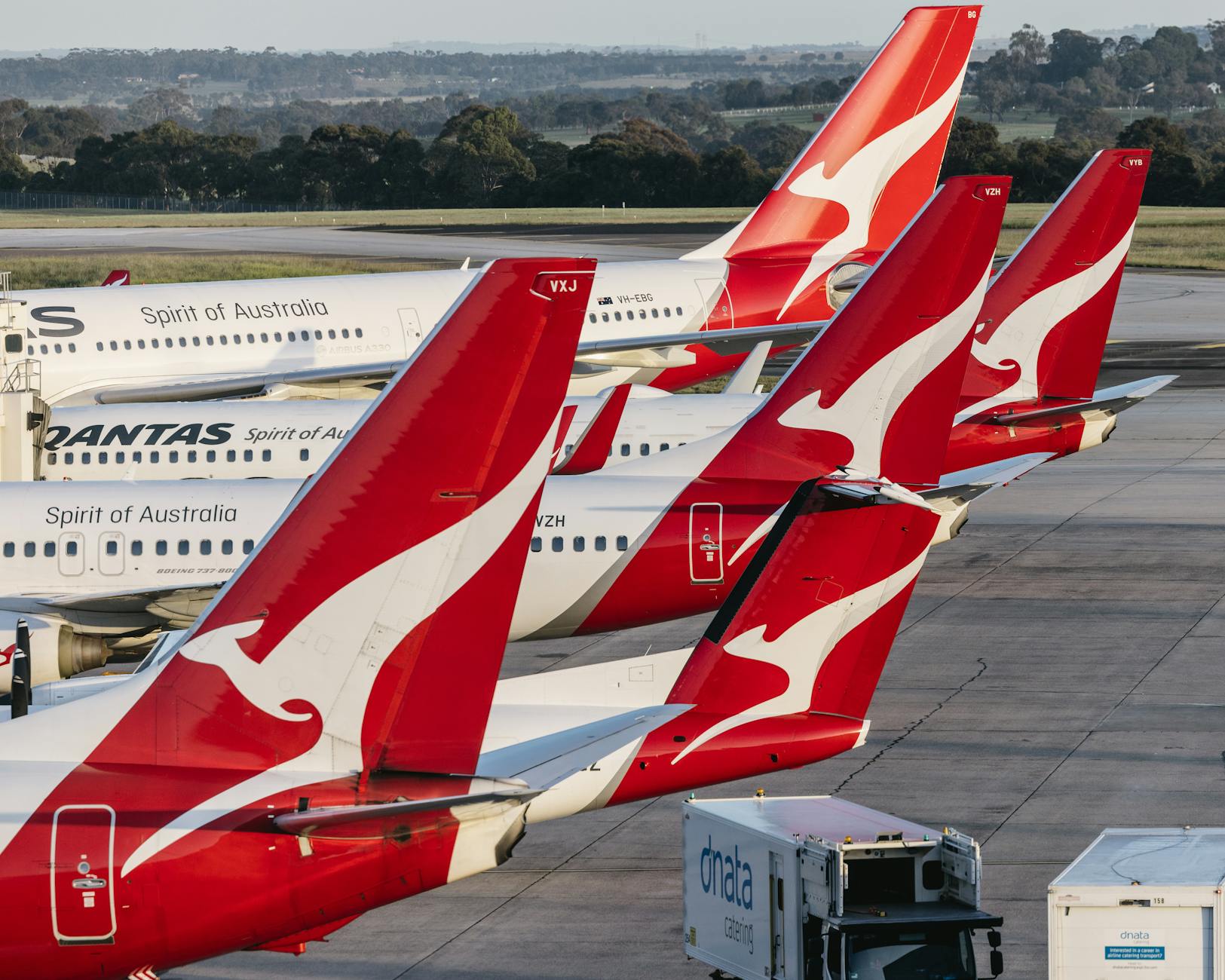
The first layer is domestic aviation. Australia’s major cities are far apart. Sydney to Perth, Brisbane to Melbourne, and Melbourne to Cairns are not casual ground trips. Domestic air travel links state capitals, major regional centers, mining towns, resort gateways, and remote communities. For visitors with limited time, flights are usually the only practical way to combine far-apart regions such as Sydney, Cairns, Uluru, Perth, and Tasmania.
The second layer is state-based public transport. Each state or territory runs or coordinates its own public transport. New South Wales uses Transport for NSW and Opal/contactless in Greater Sydney. Victoria uses myki and V/Line systems. Queensland uses Translink in South East Queensland and some regional urban bus networks. Tasmania has Metro Tasmania and regional bus operators. Western Australia has Transperth in Perth and Transwa for regional travel. These systems do not form one national fare card.
The third layer is intercity rail and coach. Australia has no nationwide high-speed rail. Rail is useful in selected corridors, such as Sydney to the Blue Mountains/Newcastle/Wollongong/Canberra-adjacent coach links, Melbourne to regional Victoria, Brisbane to Cairns on the Spirit of Queensland, and tourist rail across the continent. Coaches fill many gaps and are often the only public option between smaller towns.
The fourth layer is private vehicles. Cars are central to Australian life. In central Sydney, Melbourne, Brisbane, and Perth, a visitor can often avoid driving. In Cairns hinterland, Tasmania outside Hobart, many beaches, wine regions, national parks, and outer suburbs, a private car can move from optional to essential. The Australian Government notes that visitors can hire a car and drive with a foreign driver licence for up to three months, and that drivers must keep left.
The fifth layer is water transport. Ferries are everyday public transport in Sydney, Brisbane, Hobart’s Derwent crossing, and Perth’s Swan River service, while private ferries connect tourism destinations such as Rottnest Island, MONA, reef tours, islands, and harbor cruises. Ferries can be functional transport, sightseeing, or both.
The sixth layer is active transport and micromobility. Walking is strong in central business districts and waterfront areas. Cycling infrastructure is improving but varies sharply by city. E-scooters are legal in some jurisdictions and restricted or prohibited in others; travelers should never assume that a rental e-scooter rule in Brisbane applies in Sydney or Hobart.
The result is a country where the correct transport choice changes by scale. For a central-city museum day, use public transport and walk. For Sydney to Melbourne, fly unless you deliberately want the train or a road trip. For the Great Barrier Reef, book a boat. For the Daintree, Tasmania’s east coast, the Blue Mountains backroads, Margaret River, or remote outback routes, plan around cars, tours, weather, fuel, and mobile coverage.
2. The first decisions every visitor should make
A traveler to Australia should make five transportation decisions before arrival.
2.1 Decide whether the trip is city-based or landscape-based
If the trip is mostly Sydney, Melbourne, Brisbane, Perth, Hobart waterfront, or central Cairns, public transport, walking, taxis, rideshare, and airport transfers may be enough. If the trip includes beaches outside the core, national parks, wineries, rainforest, remote lookouts, multi-town itineraries, or family visits in outer suburbs, the plan may require a rental car or organized tour.
This distinction matters more in Australia than in many rail-dense countries. A train station near a town does not mean easy access to the attraction itself. Many famous Australian landscapes are outside frequent public transport range.
2.2 Decide city-by-city payment tools
Australia does not have one national equivalent of Japan’s IC-card interoperability or London’s contactless fare system. The practical setup is city-specific:
| Area | Common public transport payment approach | Key caution |
|---|---|---|
| Sydney / NSW core | Opal card or contactless credit/debit card | Airport station access fee applies on Sydney Airport train trips. |
| Melbourne / Victoria | myki normally; temporary free/discount fare period in 2026 | myki rules differ for trams, trains, buses, and the Free Tram Zone. |
| Brisbane / Cairns / Queensland Translink areas | go card, contactless in SEQ, paper/cash in some regional areas | Current 50-cent fare policy has exclusions, especially Airtrain. |
| Hobart / Tasmania | Metro Greencard or onboard tickets | Greencard is physical and not a digital-wallet product. |
| Perth / WA | SmartRider, contactless Visa/Mastercard, cash tickets | Contactless charges the standard cash fare; concessions need SmartRider. |
2.3 Decide how to handle airports
Australian airport access varies widely:
Airport cost surprises are common. A visitor who expects airport rail to be the cheapest option everywhere may be wrong, especially for groups.
2.4 Decide whether to drive
Driving can be the best or worst decision depending on the itinerary. It is often bad for dense central business districts because of parking, one-way streets, tolls, traffic, and hotel parking fees. It is often good for national parks, coastal touring, suburban family visits, wineries, and rural accommodation.
Visitors should know the basic national pattern: Australia drives on the left; roads use kilometers; seatbelts are compulsory; motorcycle, scooter, e-bike, and bicycle helmet rules are strict; mobile-phone rules are strict; and speed enforcement can be unforgiving.
2.5 Decide which navigation tools to trust
Google Maps is widely used in Australia and is generally useful for public transport, driving, and walking. But official journey planners and apps can be more accurate during construction, service changes, ferry disruptions, and special events. For each city, install or bookmark the official planner:
For driving, check state road authorities, live traffic tools, and weather warnings before long rural drives.
- Sydney has a fast airport train, but it includes an airport station access fee.
- Melbourne has no direct airport rail service in normal use; SkyBus, taxi, rideshare, shuttle, rental car, and private transfer are the main options.
- Brisbane has Airtrain, but Queensland’s 50-cent fare policy excludes Airtrain.
- Cairns Airport is close to town but relies on taxis, rideshare, shuttles, rental cars, and private transfers rather than rail.
- Hobart Airport uses SkyBus, taxis, rideshare, and car rental.
- Perth Airport has rail access to Terminals 1 and 2 through Airport Central, while Terminals 3 and 4 require a bus connection to Redcliffe Station.
- Transport for NSW Trip Planner for Sydney and NSW.
- Transport Victoria or PTV tools for Melbourne and Victoria.
- Translink Journey Planner for Brisbane, Cairns, and Queensland services.
- Metro Tasmania and Transport Tasmania information for Hobart.
- Transperth JourneyPlanner for Perth.
3. Payment systems: what is easy, what is fragmented
Australia is moving toward contactless open payment, but the transition is uneven.
Sydney is the cleanest for visitors. Transport for NSW allows contactless payment on public transport and states that travelers can tap on and off with the same card or device to receive an adult Opal fare and benefits such as transfer discounts and fare caps. Opal cards still matter for children, concessions, and people who prefer a stored-value card.
Melbourne is more complicated because the normal system is myki, not universal open-loop contactless. myki requires tapping on, and in many circumstances tapping off, with different rules for trains, buses, trams, Zone 1 trams, Zone 2 trams, and the Free Tram Zone. Melbourne also has a major date-sensitive fare situation at the time of this report: Victoria’s transport department says public transport is free across the state until May 31, 2026, followed by half-price fares until January 1, 2027.
Queensland’s Translink network is also changing. go card remains important and works across bus, train, ferry, tram, and Airtrain services in the greater Brisbane/South East Queensland region. Smart Ticketing contactless payments are available on all South East Queensland trains, trams, ferries, and buses, with Visa and Mastercard credit/debit cards and digital wallets accepted. Queensland’s current 50-cent flat-fare policy makes many local trips unusually cheap, but Airtrain and some private services are excluded.
Hobart is more old-school. Metro Tasmania’s Greencard is a physical smartcard. Metro states that it gives a fare discount and works on Metro Tasmania, Derwent Ferries, and Tassielink services, but it does not support digital payments. Visitors can still buy single fares, but Greencard is the local tool for repeat use.
Perth is modernizing quickly. Transperth allows contactless Visa/Mastercard and digital wallets, but notes that contactless users pay the standard cash fare and that concessions require SmartRider. SmartRider remains valuable for locals because it supports discounts, autoload, caps, and regular-use benefits.
The big warning is card clash. In systems where contactless payment is accepted, do not tap a wallet, purse, or phone case containing multiple cards. Use one physical card or one phone wallet consistently. Sydney and Perth explicitly emphasize using the same card or device for trips and avoiding card confusion.
4. Domestic air travel and airports
Australia’s domestic aviation system is not a luxury add-on; it is a practical necessity for many itineraries. The distance from Sydney to Perth is roughly equivalent to crossing a large part of Europe. Melbourne to Cairns is long enough that most travelers fly. Brisbane, Hobart, Perth, Cairns, and Sydney all function as separate travel regions, not as easy day-trip spokes from one national hub.
4.1 When to fly
Fly when:
4.2 When not to fly
Do not fly automatically when:
4.3 Airport transfer friction
Airport transfers are one of the most common places visitors overspend. Sydney Airport rail is fast but has an access fee; Brisbane Airtrain is separate from the 50-cent public-transport fare policy; Melbourne Airport relies on buses and road access; Perth’s airport train is excellent for T1/T2 but not a direct one-seat ride from T3/T4; Cairns and Hobart lack urban rail airport links. For two or more people with luggage, taxi or rideshare can sometimes beat rail or airport buses on cost, comfort, or simplicity.
- The cities are in different regions and time is limited.
- The drive would take more than a full day and the landscape is not the purpose.
- The train is primarily scenic but not time-efficient.
- Weather, school holidays, or event demand make roads and accommodation difficult.
- You are connecting to islands, reef tours, remote communities, or Tasmania.
- You are doing a scenic coastal or outback road trip.
- The destination is close to a state capital by train, such as Sydney to the Blue Mountains, Melbourne to Geelong/Ballarat/Bendigo, or Perth to Fremantle.
- You have bulky sports equipment and a car is more efficient.
- You need flexibility for multiple small towns.
5. Intercity rail: useful, scenic, but not high-speed national travel
Australia’s intercity rail should be treated realistically. It is not a universal fast network. It is a set of state corridors, regional services, and tourism rail experiences.
5.1 NSW TrainLink
NSW TrainLink runs regional train and coach services to more than 365 destinations across New South Wales, Victoria, Queensland, and the Australian Capital Territory. For visitors, it is useful for places such as the Blue Mountains, Newcastle, Wollongong, the Central Coast, Canberra connections by train/coach, the North Coast, and regional NSW itineraries. It can be slower than driving or flying, but it is often comfortable and scenic.
5.2 V/Line and regional Victoria
Victoria’s V/Line network is important for Melbourne-based regional trips. Transport Victoria notes that paper or electronic tickets are needed for some regional train, bus, and coach trips, and that trips crossing myki and paper-ticket zones may require a whole-journey paper/e-ticket rather than separate myki tapping. This is a classic visitor trap: Melbourne’s urban myki habits do not automatically extend to every regional journey.
5.3 Queensland Rail Travel
Queensland Rail Travel’s Spirit of Queensland connects Brisbane and Cairns over a 1,681-kilometer route taking about 25 hours. It is not faster than flying, but it is meaningful for travelers who want the rail experience or are linking coastal Queensland destinations.
5.4 Long-distance tourist rail
Journey Beyond operates iconic tourist rail services such as The Ghan, Indian Pacific, Great Southern, and The Overland. These should be understood as premium travel experiences, not cheap commuter transport. They are valuable if the journey itself is the attraction.
5.5 Coaches
Coaches matter because rail gaps are large. They connect towns, tourist regions, university cities, ski fields, coastal destinations, and remote communities. They can be cheaper than flying and more direct than train-plus-local-transfer combinations. But coach travel is vulnerable to long distances, weather, road closures, wildlife collisions, and limited late-night arrivals.
6. Private vehicles, rental cars, campervans, and road rules
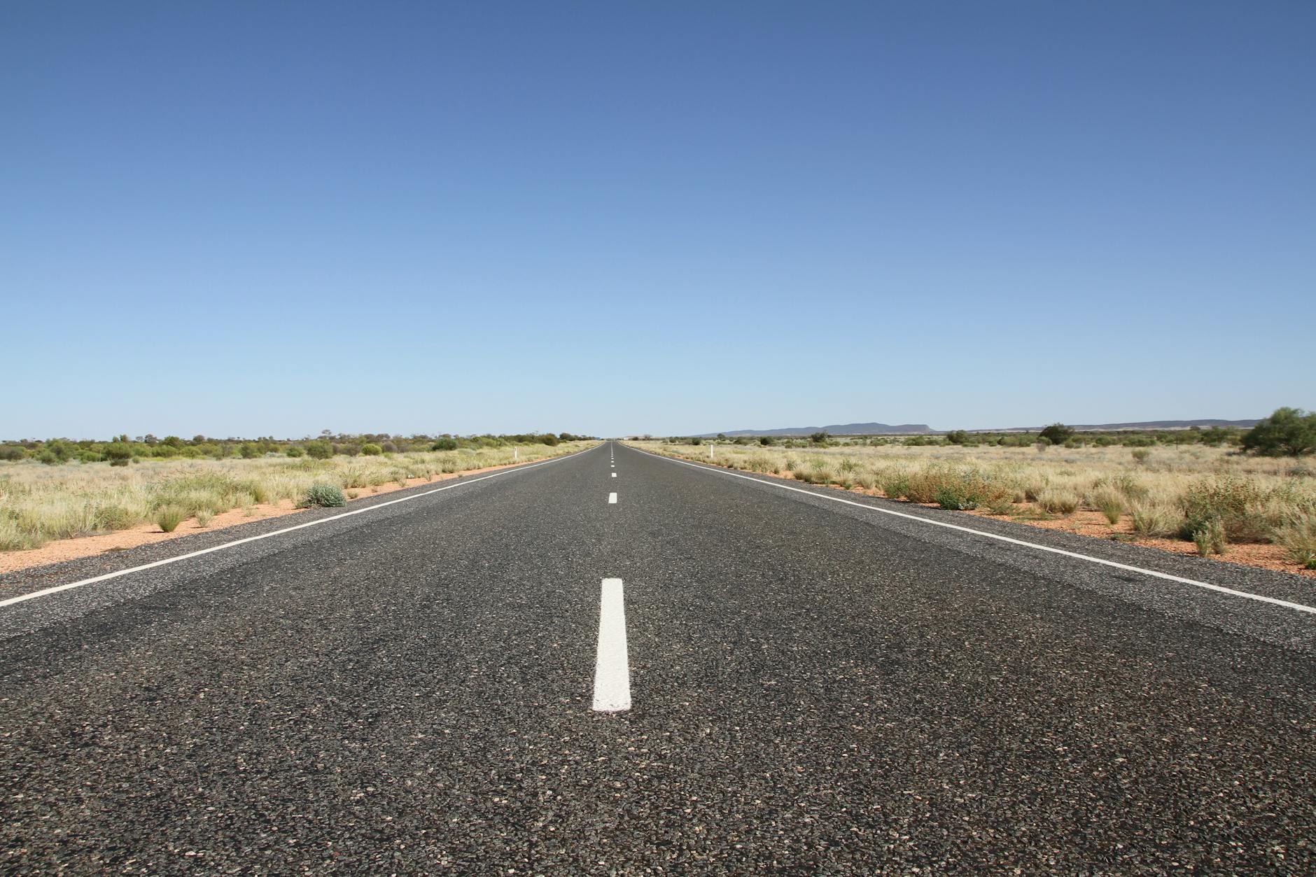
Australia is easy to underestimate as a driving country. Roads can be excellent, but distances, heat, wildlife, storms, fatigue, and service gaps can become serious concerns.
6.1 Licence rules for visitors
Austroads states that visiting drivers can generally drive using a valid overseas licence, with state-specific limits such as three months in the Northern Territory and six months in New South Wales and Victoria, and that drivers must carry an International Driving Permit or English translation if the licence is not in English. Tourism Australia similarly says visitors may drive with a foreign licence for up to three months when it is in English, and need an International Driving Permit if it is not.
The practical advice is simple: carry your physical licence, passport or ID, and IDP/translation if needed. Do not rely on a photo of your licence.
6.2 Road rules and enforcement
Australia drives on the left. Seatbelts are compulsory. Speed limits are in kilometers per hour. Tourism Australia summarizes common default limits as 50 km/h in many urban areas and 100 or 110 km/h on many rural roads and highways, depending on posted signs. Speed cameras, mobile phone cameras, random breath testing, and parking enforcement are common.
Phone use rules are strict. Tourism Australia warns that using a mobile phone while driving is illegal even when stopped in traffic unless it is hands-free or in a proper mount according to local rules. Do not hold the phone at a red light.
6.3 Parking and tolls
Central-city parking is expensive. Hotels may charge daily parking fees. Parking signs can be confusing, especially in dense parts of Sydney, Melbourne, Brisbane, and Perth. Australian signs such as 2P, 1P, No Stopping, Clearway, Permit Zone, Loading Zone, and time-limited restrictions must be read carefully. Tourism Australia notes that parking signs such as 2P or 3P indicate how long a vehicle can remain in that location.
Sydney, Melbourne, and Brisbane have toll roads. Rental car companies usually offer toll-payment arrangements, but they may add administration fees. Visitors should ask about toll policy at pickup and avoid assuming they can pay cash at toll booths.
6.4 Remote, rural, and outback driving
The Australian Government warns that outback roads can be rough and unsuitable for some vehicles, and travelers should confirm that a hire car is suitable before driving in the outback. The Department of Infrastructure’s travel-safety material stresses planning, rest, fuel, left-side driving, wildlife at sunrise and sunset, staying with the vehicle in an emergency, and considering mobile coverage or satellite communication in remote areas.
Important rural-driving risks:
For many visitors, a guided tour is better than a rental car for remote destinations.
- Fatigue from long, monotonous distances.
- Kangaroos, livestock, and wildlife, especially dawn and dusk.
- Road trains, which are very long and need space.
- Unsealed roads that may violate rental agreements.
- Flash flooding and closed roads.
- Heat, dehydration, and lack of shade.
- Patchy phone coverage.
- Fuel gaps.
7. Urban public transport modes
7.1 Heavy rail and metro
Sydney, Melbourne, Brisbane, and Perth have the strongest urban rail systems among the cities in this paper. Sydney also has a driverless metro, including the M1 line, with major extensions and conversions changing the network. Perth has clean radial rail corridors. Brisbane’s rail is a regional metropolitan network across South East Queensland. Melbourne has the largest suburban rail culture among these cities but uses older infrastructure and has a CBD-focused radial pattern.
7.2 Trams and light rail
Melbourne is Australia’s tram icon. Trams are essential for central Melbourne, inner suburbs, universities, sports precincts, hospitals, and tourist movement. Sydney has modern light rail lines through the CBD, Inner West, Randwick, and Kingsford. Brisbane has trams on the Gold Coast, not central Brisbane itself. Perth, Hobart, and Cairns do not have everyday urban tram systems for visitors.
7.3 Buses
Buses are the least glamorous but often most important public transport mode. They serve beaches, outer suburbs, hillside suburbs, universities, hospitals, shopping centers, and rail gaps. In Cairns and Hobart, buses are the core public network. In Brisbane, busways and high-frequency routes are central to the system. In Sydney and Melbourne, buses are essential for last-mile movement beyond rail and tram corridors.
7.4 Ferries
Ferries are not only sightseeing. Sydney ferries are a legitimate public transport tool for Manly, Watsons Bay, Parramatta River areas, and harbor suburbs. Brisbane CityCats and ferries connect riverside suburbs and central destinations. Hobart’s Derwent ferry links Bellerive and central Hobart. Perth’s public ferry crosses the Swan River between Elizabeth Quay and South Perth, useful for Perth Zoo and riverfront travel. Cairns ferries and boats are mostly tourism-oriented reef and island services.
9. Walking, cycling, and micromobility
Australia’s central city areas are generally walkable, but heat, hills, road widths, and urban sprawl matter. Sydney’s CBD, Circular Quay, Darling Harbour, The Rocks, and inner harbor areas are good for walking. Melbourne’s CBD grid, laneways, Southbank, Carlton, Fitzroy, and sports precinct are walkable. Brisbane’s river paths are strong but summer heat matters. Perth’s city and waterfront are walkable, but attractions are spread out. Hobart’s center is compact but hilly. Cairns Esplanade is easy, but the wider region is not.
Cycling is improving but uneven. Helmet rules are strict across Australia. E-scooter rules are local and change frequently. Tourism Australia notes that in Sydney, e-scooters and Segways are not permitted on roads or footpaths, which is very different from Brisbane, where shared e-scooters and e-bikes are visible. Travelers should check city rules before riding.
10. Accessibility and inclusive travel
Australian public transport agencies generally publish accessibility information, but practical access varies by vehicle age, station design, wharf design, lift outages, platform gaps, and construction.
The best accessibility pattern is newer infrastructure: Sydney Metro stations, many modern light rail stops, Perth’s newer train stations, Brisbane busways, and modern ferry terminals. Older systems are less consistent. Melbourne’s tram network is extensive, but not every tram stop and not every tram vehicle is equally accessible. Hobart’s bus network can be challenging for people with mobility limitations depending on stop location and hills. Cairns tour boats, reef pontoons, rainforest tours, and beaches vary greatly in accessibility.
Practical advice:
- Use official accessibility pages, not only map apps.
- Check lift outages before station-dependent trips.
- Allow extra time for ferry boarding and older tram stops.
- Pre-book accessible taxis when timing matters.
- Ask reef, island, and tour operators about ramps, vessel boarding, beach landings, and mobility equipment.
- In hot cities, accessibility also includes shade, seating, water, and air-conditioning.
11. Etiquette, norms, and everyday behavior
Australian public transport etiquette is informal but clear.
Food and drink rules vary by mode and operator. Enforcement is usually pragmatic, but messy food, alcohol, and antisocial behavior attract attention quickly.
- Let passengers exit before boarding.
- Move down inside buses, trams, and trains.
- Offer priority seating to people who need it.
- Keep bags off seats in busy periods.
- Keep noise reasonable, especially on commuter trains.
- Tap on and tap off correctly where required.
- Do not block train doors, tram steps, ferry ramps, or bus aisles.
- Keep left on stairs and escalators where local flow expects it.
- Queue at bus stops where a queue has formed.
- Do not assume bikes, scooters, or large luggage are allowed on every service at every time.
12. Recurring concerns for visitors
Visitors most often experience these problems:
- Underestimating distance. Australia looks simple on a map but is enormous.
- Airport cost surprises. Airport trains, buses, taxis, and rideshare have city-specific costs.
- Wrong fare system. Opal, myki, go card, Greencard, and SmartRider are not the same product.
- Tapping incorrectly. Some systems require tap on and tap off; some routes have special rules.
- Assuming public transport reaches nature. Many beaches, waterfalls, mountains, wineries, and national parks need cars or tours.
- Late-night service gaps. Night services exist in some cities but are less comprehensive than daytime networks.
- Luggage friction. Stairs, older trams, busy buses, and peak-hour trains can be difficult with large bags.
- Weather. Heat, storms, bushfire smoke, floods, cyclones, and ferry conditions can change plans.
- Driving stress. Left-side driving, hook turns in Melbourne, toll roads, roundabouts, road trains, wildlife, and parking signs can be intimidating.
- Event crowding. Sports, concerts, festivals, and school holidays change travel times dramatically.
13. Recurring concerns for locals
Locals face a more structural set of issues:
- Housing affordability pushes people farther from jobs, increasing commute lengths.
- Outer suburbs can be car-dependent despite nominal bus service.
- Peak-hour crowding affects rail, tram, busway, and ferry corridors.
- Reliability varies during storms, heat, flooding, construction, and staff shortages.
- Parking costs and tolls influence household budgets.
- Fuel prices affect families, tradespeople, and regional residents.
- Public transport coverage is often radial, making cross-suburban trips slow.
- Regional and remote residents have fewer transport choices and higher travel burdens.
- Accessibility improvements are uneven and require long-term capital spending.
- Fare policy changes can help riders but create confusion during transitions.
1. System snapshot
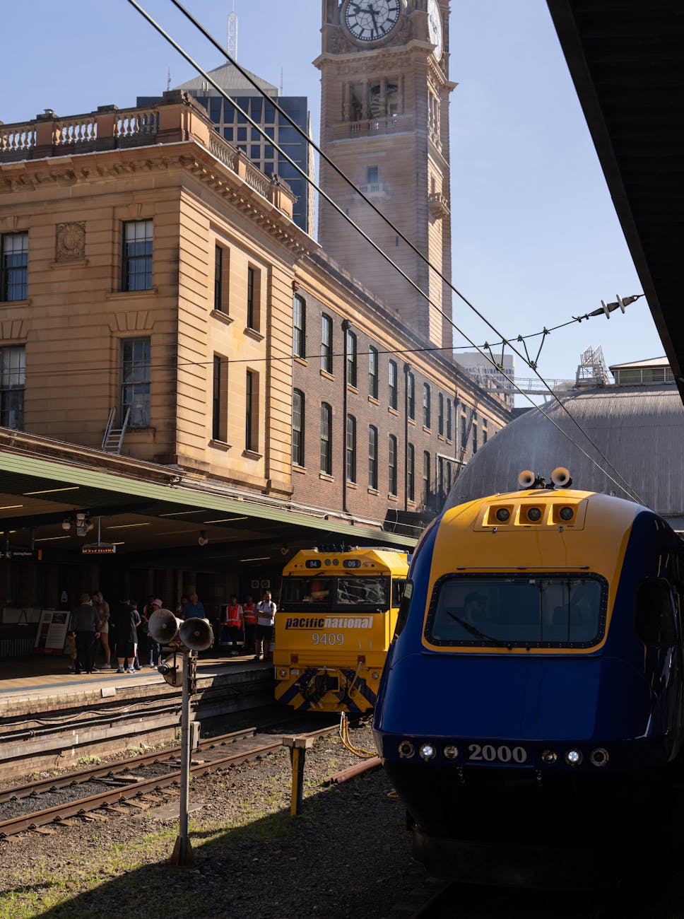
Sydney has the most varied public transport ecosystem in Australia: suburban trains, driverless metro, light rail, buses, ferries, airport rail, regional trains, taxis, rideshare, walking corridors, cycling routes, toll roads, and a large road network. Transport for NSW’s official transport page centers travel around metro, train, bus, ferry, light rail, regional train, and coach services, with Opal as the main fare system.
For visitors, Sydney is the easiest Australian city in this paper to use without a car if the trip stays within the city, harbor, beaches, inner suburbs, and major tourist corridors. It is also one of the worst cities in which to casually rent a car for central sightseeing because of traffic, tolls, parking cost, and complicated road approaches around the CBD.
2. What is unique and important
Sydney’s defining transport feature is that water, rail, and road are all central to the city’s geography. The harbor is not decorative; ferries are part of the daily network. Rail lines are essential for long-distance movement across Greater Sydney. Buses fill the many gaps created by hills, waterways, beaches, and low-density suburbs.
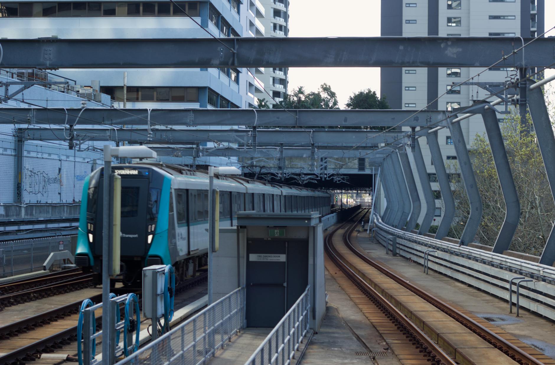
The other defining change is Sydney Metro. Sydney Metro describes itself as Australia’s biggest public transport project, with fully accessible driverless metro service and multiple expansion projects. The M1 metro opened first in the northwest and was extended through the city to Sydenham in August 2024, dramatically changing north-south travel through the CBD. The Sydenham-to-Bankstown conversion is a major continuing disruption and is expected to open in the second half of 2026, with replacement Southwest Link buses during the conversion period.
3. Main modes
3.1 Sydney Trains
Sydney Trains is the backbone for many visitor trips: airport, Circular Quay, Town Hall, Central, the Blue Mountains connection, Bondi Junction, Parramatta, Chatswood connections, Olympic Park event travel, and suburban movement. Trains are generally the best choice for longer urban distances.
3.2 Sydney Metro
Sydney Metro is fast, frequent, accessible, and easy to use. Transport for NSW describes metro as a fully accessible, automated, driverless network and notes that travelers can use contactless payment or Opal. The metro is especially useful for trips through Chatswood, North Sydney/Victoria Cross, Barangaroo, Martin Place, Gadigal/Town Hall area, Central, Waterloo, and Sydenham corridors.
3.3 Light rail
Sydney’s light rail is useful for the CBD, Chinatown, Darling Harbour, Pyrmont, Surry Hills, Moore Park, Randwick, Kingsford, and Inner West areas. It is slower than heavy rail for long distances but valuable for short and medium trips where the stop is close to the destination.
3.4 Buses
Buses are essential for beaches, northern suburbs, eastern suburbs beyond rail, inner-west gaps, and late-night replacement services. Visitors going to Bondi Beach, Coogee, Watsons Bay, Manly local areas, or many residential neighborhoods will likely use buses.
3.5 Ferries
Sydney ferries are both useful and beautiful. Manly, Watsons Bay, Taronga Zoo, Barangaroo, Parramatta River stops, Neutral Bay, and Mosman-area services can turn transit into sightseeing. Ferries are weather-sensitive and may have reduced frequency at night.
4. Payment and fares
Sydney is visitor-friendly because contactless payment works well. Transport for NSW says riders can tap on and off with the same contactless card or linked device and receive adult Opal fare benefits, including transfer discounts, caps, and off-peak discounts. Opal fare rules depend on where, when, and how far someone travels; bus, ferry, and light rail fares are distance-based, and journeys include a transfer window.
The main warning is the Sydney Airport station access fee. Transport for NSW states that the station access fee is added to fares when tapping on or off at Domestic or International Airport stations. For one person, the train is usually still fast and convenient. For a family or group, taxi or rideshare may compete on price.
5. Airport access
Sydney Airport is close to the CBD and has a fast rail link. Sydney Airport states that the train to the city takes about 13 minutes and runs about every 10 minutes, with Opal or contactless card payment accepted. The same source gives a typical taxi/rideshare CBD estimate of about 20 minutes and $45 to $55 one way, though traffic and time of day matter.
Practical choices:
- Solo traveler to CBD: airport train is usually best.
- Two to four people with luggage: compare train access fees against taxi/rideshare.
- Late night: check train operating times; taxi/rideshare may be easier.
- Suburban destination: direct taxi/rideshare may beat train-plus-transfer.
7. Traveler concerns
Visitors should watch for:
- Airport station access fee.
- Using the same card/device for tap on and tap off.
- Card clash in phone cases and wallets.
- Ferry cancellations or reduced service during bad weather.
- Light rail crowding after sports events.
- Train trackwork on weekends.
- Replacement buses during Metro Southwest conversion.
- Beach buses stuck in traffic on summer weekends.
- Expensive CBD and hotel parking.
8. Local concerns
Sydney locals deal with high housing costs, long cross-city commutes, crowded peak trains, bus reliability in traffic, weekend trackwork, toll-road costs, parking scarcity, and construction disruptions. The new metro improves many trips, but it also creates transitional pain during line conversions and station-area redevelopment.
9. Best-use strategy
Use rail or metro for long urban distances, light rail for central corridors, ferries for harbor trips, buses for beaches and neighborhoods, and taxis/rideshare for late-night or luggage-heavy trips. Avoid renting a car for central Sydney unless the itinerary clearly needs it.
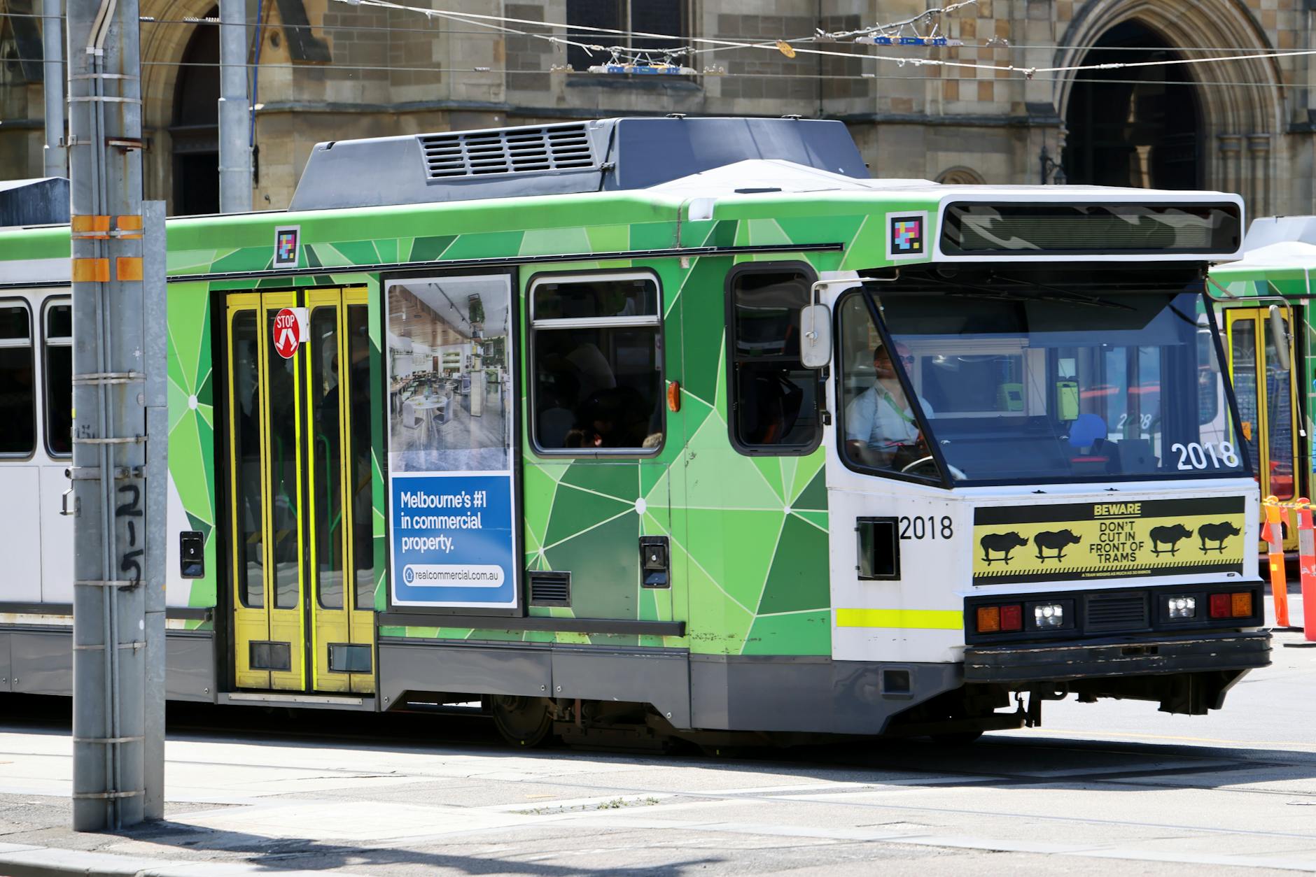
1. System snapshot
Melbourne is Australia’s tram city. It also has a large suburban train network, buses, regional V/Line services, taxis, rideshare, cycling routes, and an airport bus system. Its transport culture is different from Sydney: trams shape inner-city movement, the CBD grid is walkable, and suburban rail radiates from the center.
For visitors, Melbourne is very usable without a car if the trip focuses on the CBD, inner north, inner east, St Kilda, Southbank, Docklands, universities, galleries, restaurants, markets, and sports precincts. A car becomes useful for the Great Ocean Road, Yarra Valley, Mornington Peninsula, Phillip Island, Dandenong Ranges, and suburban destinations not near rail or tram.
2. What is unique and important
Melbourne’s defining feature is the tram network, especially the Free Tram Zone in the CBD and Docklands. Transport Victoria explains that travel is free within the Free Tram Zone and that users do not need a myki if the whole tram trip stays within that zone.
Melbourne’s second unique issue is airport access. Unlike Sydney, Brisbane, and Perth, Melbourne does not have a normal direct airport rail link in current everyday use. Tourism Australia directs visitors to SkyBus for Melbourne Airport and Avalon Airport connections, plus taxis and rideshare.
Melbourne’s third unique issue is driving culture, especially hook turns. Tourism Australia specifically warns visitors to check the meaning of hook turns before driving in Melbourne. A hook turn is a right turn made from the left lane at some intersections, mainly to keep tram tracks clear. It is legal where signed, but strange to many visitors.
3. Main modes
3.1 Trams
Trams are best for short to medium trips across the CBD and inner suburbs. They are frequent in core areas and excellent for visitors going to Queen Victoria Market, Carlton, Fitzroy, Southbank, Docklands, St Kilda, the Arts Precinct, Melbourne Museum, hospitals, universities, and sporting venues.
Cautions:
3.2 Suburban trains
Trains handle longer suburban distances and regional connections through major stations such as Flinders Street, Southern Cross, Melbourne Central, Parliament, and Flagstaff. They are best for outer suburbs, beach suburbs on rail corridors, events, and transfers to V/Line.
3.3 Buses
Buses fill gaps between rail and tram lines, especially in middle and outer suburbs. They are essential for cross-suburban travel but often less intuitive for visitors than trams and trains.
3.4 V/Line
V/Line is important for regional Victoria: Geelong, Ballarat, Bendigo, Seymour, Traralgon, and other regional centers. The ticketing boundary between myki and paper/e-ticket travel is a common confusion point.
- Older trams and some stops are not fully accessible.
- Trams can be slower than trains over long distances.
- Cars, traffic lights, and events can delay trams.
- The Free Tram Zone is useful but geographically limited.
4. Payment and fares
Under normal conditions, Melbourne uses myki. Transport Victoria says riders should tap on every time and tap off on trains, V/Line, buses, and Zone 2 trams; Zone 1 tram riders tap on but do not need to tap off. It also explains that the Free Tram Zone does not require tapping if the entire tram trip starts and ends inside the zone.
At the date of this report, however, Victoria is in a special fare period. Transport Victoria says public transport is free across Victoria from March 31 to May 31, 2026, including Melbourne trains, trams, and buses, and regional trains, coaches, and buses; airport buses, ferries, and privately run services are excluded. It also says half-price travel will apply from June 1, 2026, until January 1, 2027.
This temporary fare policy is excellent for travelers, but it is exactly the kind of information that should be checked again near the travel date.
5. Airport access
Melbourne Airport and Avalon Airport are bus-and-road airport systems for most travelers. Tourism Australia lists SkyBus as the dedicated airport bus linking Melbourne Airport and Avalon Airport with Southern Cross Station, along with taxis and rideshare.
Practical choices:
- Solo traveler to CBD: SkyBus is usually straightforward.
- Group with luggage: compare SkyBus cost with rideshare/taxi.
- Late arrival: check SkyBus timetable and hotel access from Southern Cross.
- Outer suburb: taxi/rideshare or pickup may be simpler.
- Road trips: renting at the airport can make sense if leaving the city immediately.
7. Traveler concerns
Visitors should watch for:
- Temporary fare rules changing after travel dates.
- Free Tram Zone boundaries.
- Forgetting to tap correctly outside free areas.
- Older inaccessible tram stops.
- No direct airport rail.
- Hook turns and tram lanes when driving.
- Major event crowds near MCG, Marvel Stadium, Rod Laver Arena, and Albert Park.
- V/Line ticketing differences.
- Weather: Melbourne can change quickly, making walking plans less pleasant.
8. Local concerns
Melbourne locals deal with suburban sprawl, rail disruptions during construction, tram delays in mixed traffic, bus frequency gaps, outer-suburban car dependence, airport-link frustration, parking costs, and event congestion. The tram network is beloved, but it is not fast for every trip.
9. Best-use strategy
Walk and tram-hop inside the CBD and inner city, use trains for longer distances, use V/Line for regional trips, use SkyBus or rideshare for airport access, and rent a car only when leaving Melbourne or visiting places public transport cannot serve efficiently.
1. System snapshot
Cairns is not a rail-and-metro city. It is a tropical tourism gateway where transportation revolves around walking in the CBD and Esplanade area, local buses, taxis, rideshare, shuttles, rental cars, tour transfers, reef boats, long-distance coaches, and the Spirit of Queensland rail service. Cairns Regional Council states that local bus services are provided through Translink/Sunbus and connect the city, northern beaches, and southern suburbs through the Lake Street bus terminal; the Council itself does not operate the buses.
For visitors, Cairns is easy in the center and more complicated outside it. Reef trips start from the waterfront. Many rainforest, waterfall, tableland, beach, and wildlife experiences need tours, rental cars, or shuttle arrangements.
2. What is unique and important
Cairns is a tourism mobility city, not a commuter-rail city. The most important transport modes for many visitors are not buses or trains but boats, tour coaches, shuttle vans, rental cars, and airport transfers.
The second unique feature is geography. Cairns is a gateway to the Great Barrier Reef, the Daintree, Kuranda, Atherton Tablelands, Palm Cove, Port Douglas, and other destinations that are not all served by frequent public transport. A hotel in central Cairns can be walkable for restaurants and reef terminals but not for rainforest touring.
The third issue is climate. Heat, humidity, heavy rain, cyclones, and flooding can affect road conditions, walking comfort, and tour operations.
3. Main modes
3.1 Walking
Central Cairns is walkable, especially the Esplanade, marina, lagoon, restaurants, hotels, and reef departure points. Many visitors can avoid a car for the first day or two if staying centrally.
3.2 Local buses
Cairns local buses are part of Translink’s regional network. Translink’s Cairns fare page lists local bus ticket options and notes that bus drivers accept cash, with exact or small change recommended. Current Translink information lists 50-cent single fares, $1 daily tickets, and $5 weekly tickets for Cairns regional urban buses under Queensland’s fare policy.
The bus network is useful for budget travelers, workers, students, and some beach/suburb trips, but service frequency and route geometry may not match tourist sightseeing plans.
3.3 Reef boats and tour transfers
For reef travel, the boat is the main transport mode. For rainforest and tablelands tours, operator pickup may be the easiest option. Visitors should confirm pickup location, boarding time, cancellation policy, weather rules, seasickness advice, and luggage/storage limits.
3.4 Long-distance rail and coach
Cairns Regional Council notes that long-distance coaches depart from the Reef Fleet Terminal and that the Spirit of Queensland connects Cairns and Brisbane across 1,681 kilometers. Queensland Rail Travel states that the Spirit of Queensland takes about 25 hours between Brisbane and Cairns.
This is scenic and useful for certain itineraries but not time-competitive with flying.
4. Payment and fares
Cairns buses are in Translink’s regional fare environment. Unlike South East Queensland, where contactless payment is now available on all trains, trams, ferries, and buses, Cairns bus travel still requires attention to regional ticket rules, paper tickets, and cash acceptance. Translink’s Cairns page specifically references single, daily, and weekly paper ticket options and cash payment on board.
Because the fare is currently very low, the bigger issue is not price but route usefulness and frequency.
5. Airport access
Cairns Airport is close to the city, but there is no urban rail airport link. Most visitors use taxi, rideshare, shuttle, hotel transfer, private transfer, or rental car. For groups or early reef departures, a pre-arranged transfer can reduce stress.
Airport transport tips:
- Confirm whether the hotel offers pickup.
- Check rideshare pickup zones before arrival.
- If renting a car, confirm insurance and restrictions for unsealed roads.
- If arriving late, do not assume public buses will fit the arrival time.
- If catching a reef boat the next morning, stay central or pre-book transport.
7. Traveler concerns
Visitors should watch for:
- No metro or commuter rail.
- Bus routes not matching tourist destinations.
- Tour pickup times earlier than expected.
- Weather disruptions to reef boats or roads.
- Seasickness on reef trips.
- Rental car restrictions for unsealed or remote roads.
- Parking near marina areas during peak departures.
- Long travel times to Daintree, Tablelands, and Port Douglas.
8. Local concerns
Cairns locals face car dependence, heat, seasonal weather disruptions, bus frequency limitations, tourism traffic, parking pressure near the waterfront, and vulnerability to flooding and cyclone-related disruption. Transport needs vary sharply between central workers, northern beaches residents, students, hospitality workers, and tour operators.
9. Best-use strategy
Stay central if you are reef-focused. Use walking for the CBD, tours for reef/rainforest packages, buses for budget local movement, taxi/rideshare for airport and late-night trips, and rental cars for beaches, tablelands, and independent exploration.
1. System snapshot
Brisbane is a river city with a regional public transport network covering trains, buses, ferries, CityCats, and links across South East Queensland. Translink coordinates the region’s journey planning, fares, go card, and Smart Ticketing. Brisbane City Council operates the city’s buses and ferry services within the Translink environment.
For visitors, Brisbane is generally manageable without a car in the inner city, South Bank, Fortitude Valley, New Farm, West End, Roma Street, Kangaroo Point, University of Queensland, and riverfront destinations. A car becomes more useful for outer suburbs, hinterland, national parks, beaches outside easy transit reach, and multi-stop day trips.
2. What is unique and important
Brisbane’s defining transport feature is the river. CityCats and ferries are not just tourist rides; they are public transport linking riverside suburbs and central destinations. Brisbane City Council describes CityCats and ferries as an essential part of the transport network, with 28 CityCats, KittyCats, and terminals between UQ St Lucia and Northshore Hamilton.
The second defining feature is Translink integration across South East Queensland. A go card can be used on Translink buses, trains including Airtrain, ferries, and trams across greater Brisbane, Ipswich, Moreton Bay, Redlands, Sunshine Coast, and Gold Coast areas.
The third defining feature at the date of this report is Queensland’s current 50-cent fare policy. Translink states that public transport fares are 50 cents flat across all zones and modes on the Translink network in Queensland, including many bus, train, ferry, tram, and on-demand services, while Airtrain is excluded.
3. Main modes
3.1 Trains
Brisbane’s rail network links the CBD with suburbs, the airport, Gold Coast, Sunshine Coast direction, Ipswich, and other parts of South East Queensland. Roma Street, Central, Fortitude Valley, South Brisbane, and South Bank are important visitor stations.
3.2 Buses and busways
Brisbane’s busway network is a major part of the city’s public transport. Buses often serve corridors that other cities might serve by metro or tram. The bus network is useful for universities, hospitals, inner suburbs, outer suburbs, and cross-river trips.
3.3 CityCats and ferries
CityCats are one of Brisbane’s best visitor-friendly modes. Brisbane City Council lists the F1 all-stops route between UQ St Lucia and Northshore Hamilton, express peak routes, and Cross River ferry routes. Ferries can be slower than buses or trains, but they are scenic, legible, and useful for riverside travel.
Brisbane City Council states that CityCat and ferry services are paid services and that smart ticketing is available with Visa, Mastercard, American Express, and smart devices, as well as go card and pre-paid paper tickets; tickets are not sold onboard.
3.4 Walking, cycling, and scooters
Brisbane has strong riverwalks and cycling corridors in central areas. Tourism Australia highlights separated bike paths, the CityLink Cycleway, and shared e-bike/e-scooter options. Heat, hills, and thunderstorms can affect comfort.
4. Payment and fares
Use go card or contactless payment where accepted. Translink says Smart Ticketing contactless payments are available on all South East Queensland trains, trams, ferries, and buses, with Visa/Mastercard cards and digital wallets accepted.
The current 50-cent fare policy makes public transport unusually cheap, but it has exclusions. Translink explicitly excludes Airtrain from the 50-cent fare policy, even though go card can be used on Airtrain.
5. Airport access
Brisbane Airport is linked to the rail network by Airtrain. This is convenient, but visitors must not assume it costs 50 cents. Airtrain is excluded from the current 50-cent fare policy.
Practical choices:
- Solo traveler to CBD: Airtrain is easy but check fare.
- Group: compare Airtrain fare with taxi/rideshare.
- Late night: check train timetable before relying on rail.
- Gold Coast/Sunshine Coast: plan rail/bus connections carefully.
7. Traveler concerns
Visitors should watch for:
- Airtrain fare not covered by the 50-cent policy.
- Ferry terminals that may not be closest to the final destination.
- Heat and humidity when walking.
- Storms and flood-related disruptions.
- Bus routes that require careful direction checking.
- Event crowding at South Bank, Suncorp Stadium, The Gabba, and riverfront precincts.
- Last-service times after late meals or concerts.
8. Local concerns
Brisbane locals deal with suburban growth, road congestion, bus reliability, rail capacity, river-crossing bottlenecks, flood vulnerability, heat, and the difficulty of building high-frequency transport across a dispersed metropolitan area. Low fares help households, but service frequency and coverage still determine whether people can realistically avoid cars.
9. Best-use strategy
Use trains for longer regional movement, buses and busways for inner and middle suburbs, CityCats for river corridors, walking for the CBD/South Bank/Valley/riverfront, and taxis/rideshare for late nights, luggage, or awkward cross-suburban trips. Check Airtrain separately from normal Translink fares.
1. System snapshot
Hobart is compact, scenic, hilly, and car-heavy. It has no urban rail or metro. Public transport is primarily buses, supplemented by the River Derwent ferry, taxis, rideshare, airport buses, private tours, car rental, walking, cycling, and private ferries such as the MONA ferry.
For visitors, central Hobart is walkable, especially the waterfront, Salamanca, Battery Point, CBD, and nearby restaurant areas. But a car, tour, or rideshare becomes useful quickly for Mount Wellington/kunanyi, MONA if not using the ferry, Richmond, Bruny Island connections, Huon Valley, Tasman Peninsula, and most of Tasmania beyond Hobart.
2. What is unique and important
Hobart’s defining transport reality is small-city car dependence. The City of Hobart notes that Greater Hobart has the highest rate of vehicle trips by car among Australian capital cities and that nearly 90 percent of households owned at least one registered vehicle in the cited census context.
The second unique feature is the Derwent River. Transport Tasmania describes the Bellerive Ferry as a link between Hobart and the eastern shore, with a crossing of about 15 minutes between Brooke Street Pier and Bellerive Pier.
The third feature is Tasmania itself. Hobart may be the entry point, but many Tasmania itineraries require regional driving. Public transport exists between some towns, but it is not designed like a dense tourist rail system.
3. Main modes
3.1 Walking
Hobart’s waterfront core is one of the most walkable areas in Australia. Salamanca Market, Constitution Dock, Brooke Street Pier, Battery Point, restaurants, hotels, and museums can often be reached on foot. Hills matter: short map distances can include steep climbs.
3.2 Buses
Metro Tasmania is the core bus operator. Tourism Australia says visitors can use a Metro Greencard or buy single tickets onboard, and that major bus departures are around Elizabeth Street or Franklin Square.
3.3 Derwent ferry
The Derwent ferry connects Brooke Street Pier and Bellerive Pier in about 15 minutes and is especially useful for eastern shore commuters and visitors who want a river crossing without driving. Transport Tasmania states that Greencard payment is accepted and that cash, card, and EFTPOS are also accepted for the ferry.
3.4 MONA ferry and private tourism transport
The MONA ferry is a private tourism service and one of Hobart’s signature transport experiences. Tourism Australia describes it as a 25-minute private ferry from Brooke Street Pier to MONA and notes that the wharf is not wheelchair accessible.
4. Payment and fares
Metro Tasmania’s Greencard is the main repeat-use smartcard. Metro states that it provides a 20 percent discount and works on Metro Tasmania, Derwent Ferries, and Tassielink, but does not support digital payments.
Greencard use is different from some larger systems: Metro explains that passengers tap on only, do not tap off, and should tell the driver the destination so the correct fare can be charged.
5. Airport access
Hobart Airport is road-based. Tourism Australia says Hobart Airport is about a 15-minute drive from the city and that SkyBus operates services to selected central stops, with taxis and rideshare also available. SkyBus describes its Hobart City Express as an airport transfer service and notes contactless tap-and-go options for one-way adult fares.
Practical choices:
- Solo traveler to central hotel: SkyBus may be easiest.
- Group or late arrival: taxi/rideshare may be better.
- Regional itinerary: rent a car at airport if leaving Hobart quickly.
- Winter or mountain trip: check road and weather conditions before driving.
7. Traveler concerns
Visitors should watch for:
- No urban rail or metro.
- Hills making walks harder than maps suggest.
- Limited evening and weekend bus frequencies.
- Physical Greencard rather than digital-wallet payment.
- MONA ferry access limitations.
- Wildlife and dark rural roads if driving outside the city.
- Weather changes on kunanyi/Mount Wellington.
- Bruny Island and regional ferry/tour timing.
8. Local concerns
Hobart locals deal with car dependence, limited public transport frequency, parking pressure, bridge and river crossing bottlenecks, housing spread, ferry expansion debates, and the challenge of serving a hilly low-density metropolitan area. The Derwent ferry helps, but it is not a complete replacement for a high-frequency regional transit network.
9. Best-use strategy
Walk the waterfront and central districts, use buses for standard urban movement, take the Derwent ferry when it fits the route, use the MONA ferry for the experience, and rent a car or book tours for Tasmania beyond the urban core.
1. System snapshot
Perth has one of Australia’s most legible public transport systems for visitors: Transperth trains, buses, ferries, free CAT buses, a central Free Transit Zone, SmartRider, contactless payment, and a useful airport rail link for Terminals 1 and 2. The city is geographically spread out, so trains are valuable for longer distances.
For visitors, Perth can be used without a car for the CBD, Northbridge, Elizabeth Quay, Fremantle, Cottesloe corridor, stadium events, airport T1/T2, and South Perth. A car becomes helpful for beaches not directly on a rail/bus corridor, Swan Valley, national parks, suburban visits, Margaret River road trips, Pinnacles, and longer Western Australia itineraries.
2. What is unique and important
Perth’s defining transport feature is a clean suburban rail network supported by buses, plus a central free-travel environment. Transperth’s visitor page explains that free travel is available in the Free Transit Zone for buses and trains under specific conditions, and that CAT buses operate free routes every 5 to 15 minutes in central areas.
The second unique feature is contactless payment. Transperth states that contactless Visa/Mastercard and digital wallets can be used, with users charged the standard cash fare and concession riders needing SmartRider.
The third feature is airport rail access. Perth Airport’s T1/T2 precinct has Airport Central Station. For T3/T4, passengers use a Route 292 bus connection to Redcliffe Station; Western Australia’s Public Transport Authority describes Route 292 as a free connection between Terminals 3/4 and Redcliffe Station.
3. Main modes
3.1 Trains
Perth’s trains are useful for airport, Fremantle, Mandurah, Joondalup/Yanchep corridor, Midland, Armadale-side corridors, and major event travel. The system is easier for visitors to understand than many older radial networks because routes are clear and stations are relatively modern.
3.2 Buses
Buses provide suburban coverage, feeder service to stations, beach access, universities, hospitals, and neighborhood trips. In the CBD, free CAT buses are especially useful. Transperth lists Blue, Green, Purple, Red, and Yellow CAT services in central Perth, plus a Surf CAT between Stirling and Scarborough Beach.
3.3 Ferry
Transperth’s public ferry connects Elizabeth Quay and South Perth, taking about 10 minutes according to Transperth’s visitor page. It is useful for Perth Zoo and riverfront movement. Private ferries connect to Rottnest Island from Perth/Fremantle areas depending on operator and season.
3.4 Walking and cycling
Perth’s CBD, Elizabeth Quay, Northbridge, Kings Park edges, and South Perth riverfront are walkable, though summer heat is a real constraint. Cycling infrastructure is useful along the river and some corridors.
4. Payment and fares
Visitors can use contactless Visa/Mastercard or digital wallet on Transperth, but contactless users pay the standard cash fare. SmartRider is better for frequent riders because it supports tagging on/off, discounts, caps, and autoload benefits.
Transperth warns that SmartRider users must tag on and tag off at the start and end of a journey, with exceptions for CAT buses and certain bus trips wholly within the Free Transit Zone; train travel still requires tagging.
Transperth also has a notable free-travel rule: it says travel is free every Sunday for SmartRider and contactless users on all bus, train, and ferry services from first to last service, excluding late-night services after midnight on Saturday.
5. Airport access
Tourism Australia explains that passengers at Terminals 1 and 2 can use Airport Central Station, while Terminals 3 and 4 require bus route 292 to Redcliffe Station for airport-line connections. The Public Transport Authority describes Route 292 as free between T3/T4 and Redcliffe Station.
Practical choices:
- T1/T2 to CBD: airport train is usually strong.
- T3/T4: allow time for Route 292 connection.
- Group with luggage: compare taxi/rideshare.
- Late night: check last trains and bus connections.
- Regional road trip: rent car at airport if leaving Perth quickly.
7. Traveler concerns
Visitors should watch for:
- Large suburban distances.
- Heat affecting walks and waits.
- Contactless charging the standard cash fare rather than SmartRider discounts.
- T3/T4 airport transfer requiring Route 292 to the rail line.
- Tag-on/tag-off rules.
- Free Transit Zone boundaries.
- Reduced frequency late at night.
- Private ferry schedules for Rottnest Island.
8. Local concerns
Perth locals deal with long-distance suburban commuting, car dependence in outer suburbs, parking cost, heat, rail shutdowns during works, feeder-bus reliability, and the challenge of serving a metropolitan area stretched along the coast and river corridors. The rail system is a major strength, but the last mile often determines whether public transport is realistic.
9. Best-use strategy
Use trains for airport T1/T2, Fremantle, longer suburban trips, and events; use CAT buses and walking in the center; use the ferry for South Perth; use SmartRider for longer stays; and rent a car for beaches, Swan Valley, national parks, or Western Australia touring.
1. Which cities are easiest without a car?
| City | Car-free visitor practicality | Reason |
|---|---|---|
| Sydney | Very high for central/harbor/beach itinerary | Strong rail, metro, buses, ferries, contactless payment |
| Melbourne | Very high for central/inner-city itinerary | Trams, trains, walkable CBD, Free Tram Zone |
| Brisbane | High for inner-city and river corridor | Trains, buses, CityCats, low current fares |
| Perth | High for CBD, Fremantle, airport T1/T2, major corridors | Trains, CAT buses, contactless, airport line |
| Hobart | Moderate for central city only | Walkable core but bus-first and car-heavy outside center |
| Cairns | Moderate for CBD/reef tours; lower for independent region travel | Walkable core but regional attractions need tours/cars |
2. Which cities have the most visitor-friendly payment?
Sydney and Perth are the easiest for international visitors because contactless bank-card payment is mature and easy to understand. Brisbane is improving quickly with Translink Smart Ticketing across South East Queensland modes. Melbourne is easy once myki rules are understood, and unusually cheap or free during the current temporary Victorian fare period, but normal myki rules are less intuitive than open-loop contactless. Hobart is straightforward but less digital. Cairns is cheap but still regionally bus-oriented and not as seamless as Brisbane.
3. Which cities have the most airport friction?
Melbourne has the biggest airport friction because it lacks direct urban rail. Brisbane has a good airport rail link but fare-policy confusion because Airtrain is excluded from Queensland’s 50-cent fare policy. Sydney has fast rail but an airport station fee. Perth is good for T1/T2 but requires a bus-rail transfer for T3/T4. Hobart and Cairns are road-based but close enough that taxis, shuttles, and rideshare are manageable.
4. Best mode by trip type
| Trip type | Best default mode |
|---|---|
| City center sightseeing | Walk + public transport |
| Airport to CBD, solo traveler | City-specific: Sydney train, Melbourne SkyBus, Brisbane Airtrain, Perth train/T292, Hobart SkyBus, Cairns taxi/shuttle |
| Airport to CBD, group with luggage | Compare taxi/rideshare to airport rail/bus |
| Beach day | Sydney: train+bus/ferry; Perth: train+bus/car; Cairns: bus/car/tour; Brisbane: train/bus to coastal regions depending destination |
| National park day | Rental car or organized tour |
| Intercity state-capital travel | Usually fly |
| Regional town travel | State rail/coach or car |
| Nightlife return | Public transport if available; taxi/rideshare otherwise |
| Remote/outback travel | Proper vehicle, safety planning, or tour |
| Tasmania touring | Rental car or organized tour |
| Great Barrier Reef | Boat/tour operator |
5. A practical setup by itinerary type
5.1 First-time Australia city trip
5.2 East coast trip: Sydney, Brisbane, Cairns
5.3 Melbourne plus regional Victoria
5.4 Tasmania trip based in Hobart
5.5 Perth and Western Australia
Australia’s transportation systems are strong but uneven. The country works best for travelers who stop looking for one universal answer and instead match the mode to the scale of the trip. In the dense cores of Sydney, Melbourne, Brisbane, and Perth, public transport is often the best choice. In Hobart and Cairns, public transport is useful but less complete. Between distant regions, flying is usually the practical option. For beaches, national parks, wineries, rainforests, island transfers, and regional landscapes, cars, tours, ferries, and shuttles often matter more than trains.
The most successful visitor strategy is: fly between distant regions, avoid cars in dense city centers, use the local payment system correctly, check airport-transfer costs, rent cars only when the itinerary genuinely needs them, and treat weather and distance as serious planning variables. Locals already understand this tradeoff because it shapes daily life: Australian mobility is a constant negotiation between excellent urban corridors and a vast, low-density geography where cars remain deeply embedded.
: myGov, “How to travel around Australia,” updated February 18, 2026. https://my.gov.au/en/services/living-arrangements/coming-to-australia/coming-to-australia-to-visit/tips-when-you-visit/how-to-travel-around-australia
: Austroads, “Drivers Visiting Australia or New Zealand.” https://austroads.gov.au/drivers-and-vehicles/overseas-drivers/visiting-drivers
: Tourism Australia, “Driving in Australia: road safety and regulations.” https://www.australia.com/en-us/facts-and-planning/getting-around/driving-in-australia.html
: Australian Government Department of Infrastructure, Transport, Regional Development, Communications and the Arts, “Travel Safely in Australia.” https://www.infrastructure.gov.au/infrastructure-transport-vehicles/road-transport-infrastructure/safety/publications/2006/travelsafe_map
: NSW TrainLink, “Regional train and coach services.” https://transportnsw.info/regional
: Transport Victoria, “Paper tickets and eTickets.” https://transport.vic.gov.au/tickets-and-myki/regional-tickets-and-fares/paper-tickets-and-etickets
: Queensland Rail Travel, “Spirit of Queensland.” https://www.queenslandrailtravel.com.au/railexperiences/ourtrains/spiritofqueensland
: Journey Beyond Rail Expeditions. https://www.journeybeyondrail.com.au/
: Transport for NSW, “Plan — transportnsw.info.” https://transportnsw.info/
: Transport for NSW, “Contactless payments.” https://transportnsw.info/tickets-opal/opal/contactless-payments
: Transport for NSW, “Opal fares.” https://transportnsw.info/tickets-opal/opal/fares-payments/opal-fares
: Transport for NSW, “Metro.” https://transportnsw.info/travel-info/ways-to-get-around/metro
: Sydney Metro, “About Sydney Metro.” https://www.sydneymetro.info/about
: Sydney Metro, “Sydenham to Bankstown.” https://www.sydneymetro.info/sydenham-bankstown
: Tourism Australia, “Getting around Sydney.” https://www.australia.com/en-us/places/sydney-and-surrounds/getting-around-sydney.html
: Sydney Airport, “Transport options.” https://www.sydneyairport.com.au/info-sheet/transport-options
: Transport Victoria, “Free PT across Victoria extended,” published March 29, 2026, updated April 19, 2026. https://transport.vic.gov.au/news-and-resources/news/free-public-transport-across-victoria
: Transport Victoria, “Tap on and off.” https://transport.vic.gov.au/tickets-and-myki/fares/tap-on-and-off
: Transport Victoria, “Travel cheaper with myki.” https://transport.vic.gov.au/tickets-and-myki/fares/travel-cheaper-with-myki
: Tourism Australia, “Getting around Melbourne.” https://www.australia.com/en-us/places/melbourne-and-surrounds/getting-around-melbourne.html
: Translink, “go card.” https://translink.com.au/tickets-and-fares/go-card
: Translink, “Smart Ticketing.” https://translink.com.au/about-translink/projects-and-initiatives/smart-ticketing
: Translink, “50 cent fares.” https://translink.com.au/tickets-and-fares/50-cent-fares
: Translink, “Cairns fares.” https://translink.com.au/tickets-and-fares/fares-and-zones/cairns
: Cairns Regional Council, “Roads, parking & transport.” https://www.cairns.qld.gov.au/experience-cairns/getting-around/roads-parking-transport
: Brisbane City Council, “CityCats and ferries.” https://www.brisbane.qld.gov.au/traffic-and-transport/public-transport/citycat-and-ferry-services
: Tourism Australia, “Getting around Brisbane.” https://www.australia.com/en-us/places/brisbane-and-surrounds/getting-around-brisbane.html
: Metro Tasmania, “Greencard.” https://www.metrotas.com.au/fares/greencard/
: Transport Tasmania, “River Derwent ferry service.” https://www.transport.tas.gov.au/public_transport/river_derwent_ferry_service
: City of Hobart, “Transport options.” https://www.hobartcity.com.au/City-services/Transport/Transport-options
: Tourism Australia, “Getting around Hobart.” https://www.australia.com/en-us/places/hobart-and-surrounds/getting-around-hobart.html
: SkyBus, “Hobart City Express.” https://www.skybus.com.au/hobart-express/
: Transperth, “Visiting Perth.” https://www.transperth.wa.gov.au/using-transperth/visiting-perth
: Transperth, “Contactless payments.” https://www.transperth.wa.gov.au/tickets-fares/contactless-payments
: Transperth, “Using SmartRider.” https://www.transperth.wa.gov.au/smartrider/using-smartrider
: Transperth, “Free travel.” https://www.transperth.wa.gov.au/tickets-fares/fares/free-travel
: Public Transport Authority of Western Australia, “New bus route connects Airport Line with Terminal 3 and 4.” https://www.pta.wa.gov.au/news/media-statements/new-bus-route-connects-airport-line-with-terminal-3-and-4
: Tourism Australia, “Getting around Perth.” https://www.australia.com/en-us/places/perth-and-surrounds/getting-around-perth.html
- Use Sydney or Melbourne public transport as the main urban mode.
- Do not rent a car until leaving the city.
- Use official journey planners for disruptions.
- Budget separately for airport transfer.
- Use contactless in Sydney/Perth/Brisbane where accepted; use myki/Greencard where needed.
- Fly between Sydney, Brisbane, and Cairns unless the rail journey is intentional.
- Use Sydney Opal/contactless.
- Use Translink/go card/contactless in Brisbane.
- In Cairns, stay central and use tours, shuttles, buses, taxis, or a rental car depending on reef/rainforest plans.
- Watch tropical weather in Queensland.
- Use trams/trains/walking in Melbourne.
- Use V/Line or a rental car for regional Victoria.
- Check temporary Victorian fare rules before travel.
- Do not assume a myki-only journey works for every regional trip.
- Use SkyBus/taxi/rideshare for airport access.
- Walk central Hobart.
- Use SkyBus/taxi/rideshare for airport.
- Use bus/ferry for urban trips when convenient.
- Rent a car or book tours for regional Tasmania.
- Avoid driving at night in wildlife-heavy rural areas where possible.
- Use Transperth trains and CAT buses for Perth/Fremantle/CBD.
- Use SmartRider for longer stays; contactless for convenience.
- Use airport rail for T1/T2 and Route 292 for T3/T4.
- Rent a car for Swan Valley, beaches beyond easy transit, Pinnacles, Margaret River, or wider WA.
- Plan for heat and long distances.